PALM TREE PRODUCTIONS
back to hikes and climbs back to Locations and Travel
Wonders of the Zerafshan Valley![]()
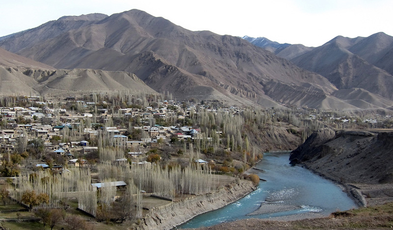
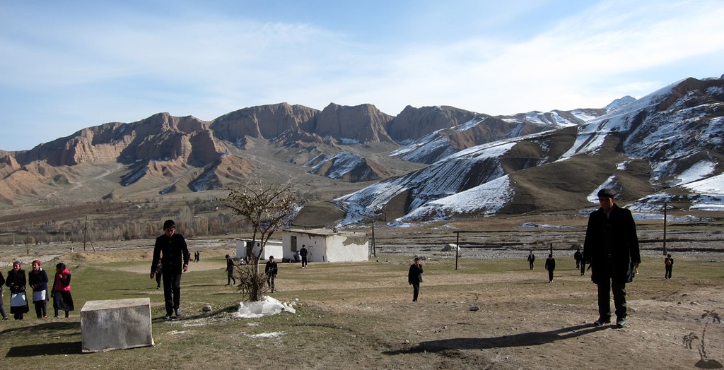
Summary: From Aini, we went westwards, along the Zerafshan River towards Penjikent, also spelled Panjakent. The Zerafshan valley in Tajikistan has several interesting sights. It also provides access to the Fan mountains from the north and is of interest to those wishing to do a traverse of the range from Iskanderkul to Panjakent, along the Seven Lakes or similar routes, during the summer months.
The Zerafshan River continues into Uzbekistan, though the border has been closed for several years. The road from Aini to Penjikent was being upgraded in late 2014, Construction is likely to continue for a while, though the road is manageable for salon cars even now.
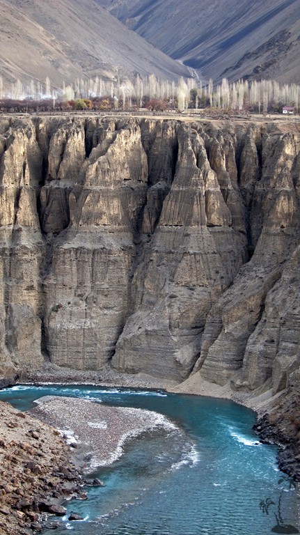
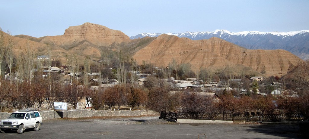
The most dramatic part of the road begins shortly after leaving Aini, where the Zerafshan has carved a deep gorge.
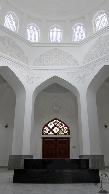
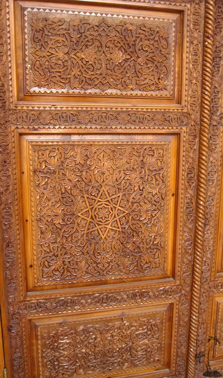
The first recommended excursion is to the Rudaki Mausoleum, some 16 kilometer south of the main road, on a good asphalt road. The mausoleum of Rudaki is a major attraction especially for Tajiks. Rudaki is recognized as the founder of Persian-Tajik literature, and sometimes called the Adam of Poets. He was born in Panjakent. The site of the mausoleum is well maintained, and the grave is certainly worth visiting.
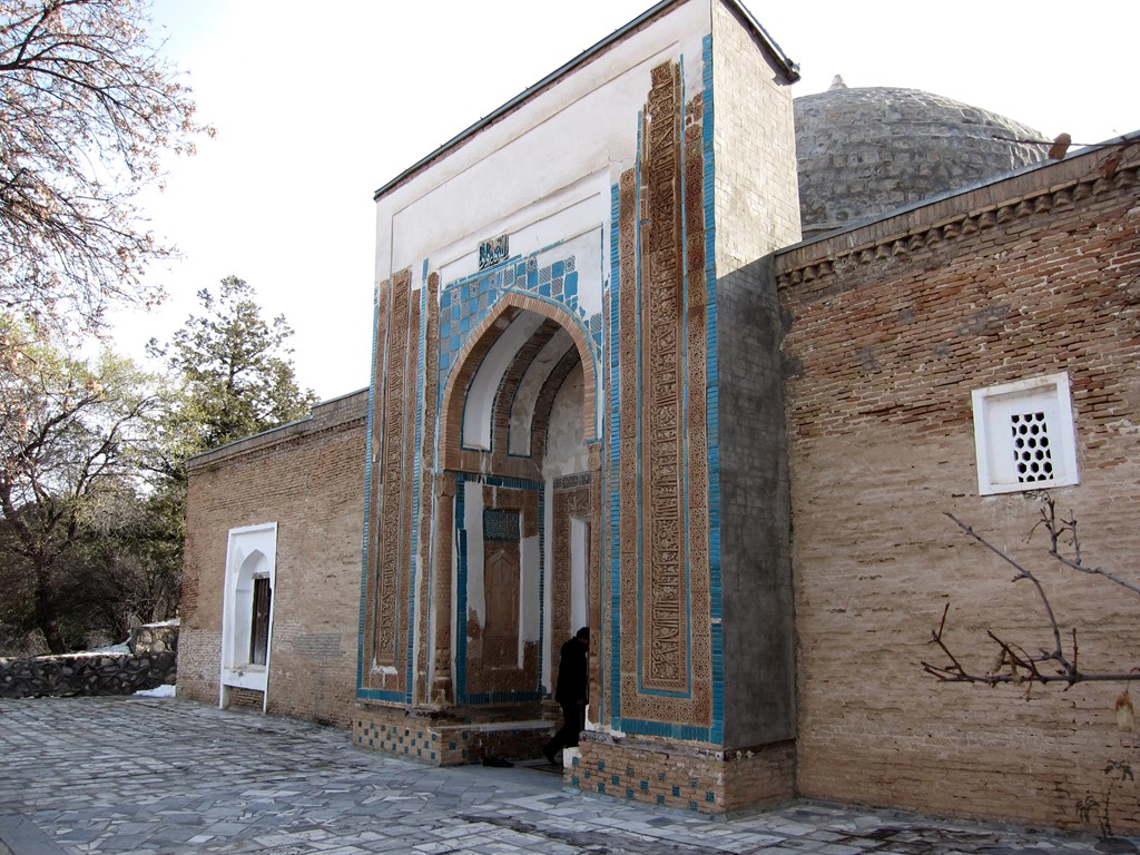
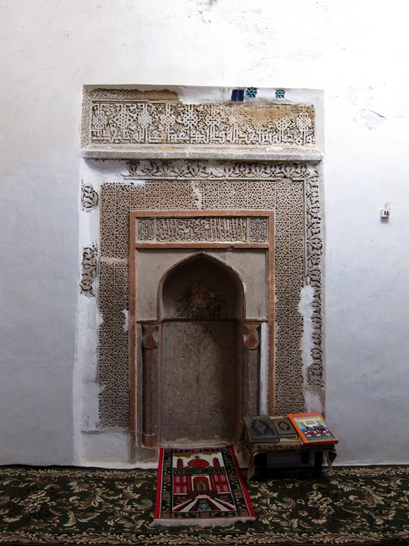
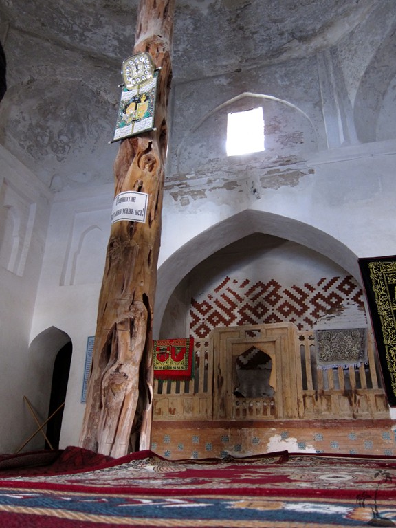
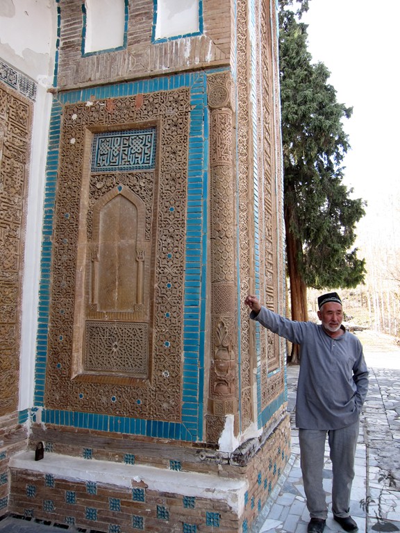
The next recommended excursion turns south off the main road at waypoint 3. It leads to the village Mazur-i-Sharif, which is the site of the mausoleum of Muhammad Bashoro. It dates back to the 9th century, and there is a guide to tell the story.
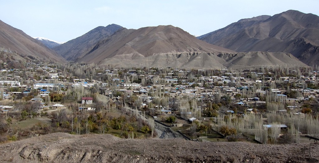
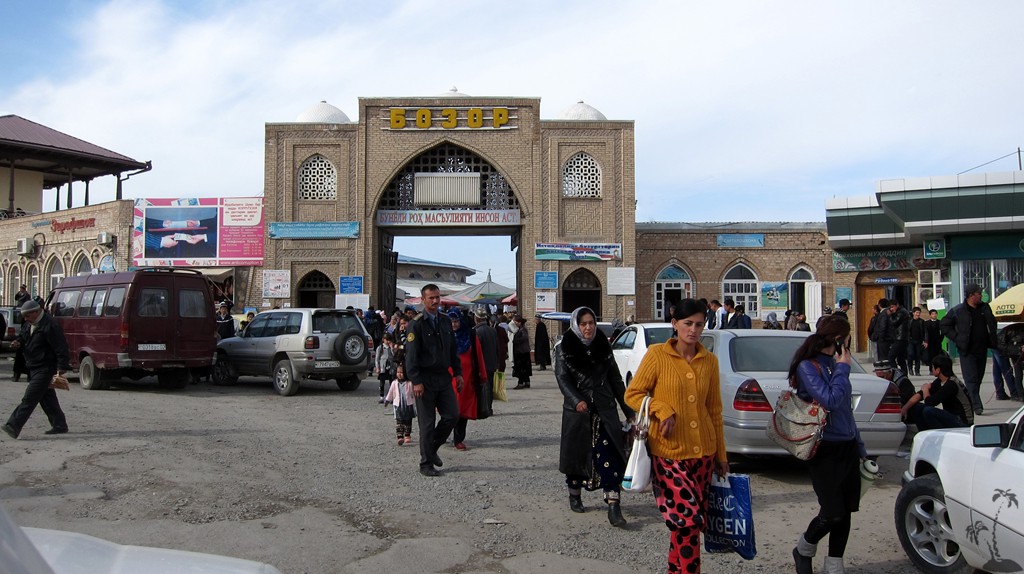
Penjikent is a lively town, at least when compared to Aini. Penjikent is only 70 kilometer from Samarkand in Uzbekistan, and it will certainly receive an economic boost once the border opens again.
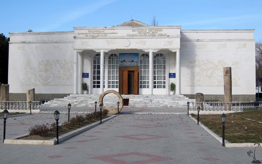
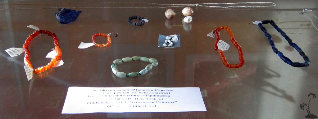
Penjikent has a small museum with Soviet memorabilia and some impressive finds from the excavations of old Penjikent and nearby Sarasm. We found the museum worth a short stop not least because of the helpful staff.
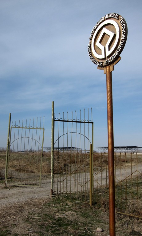
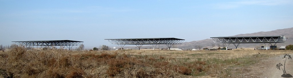
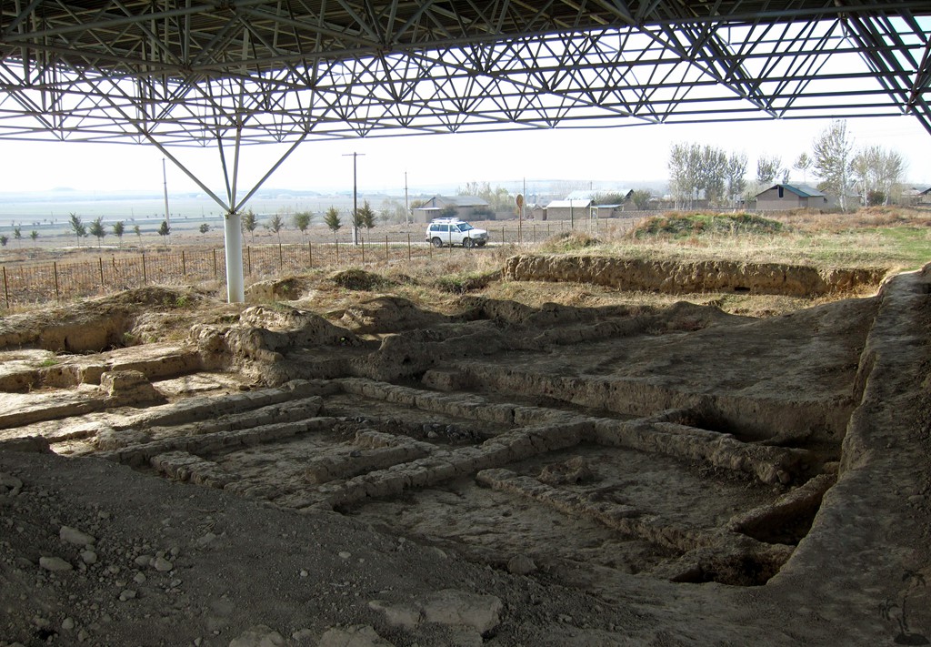
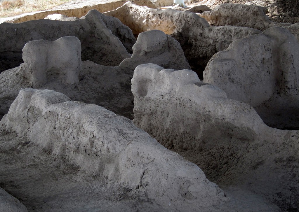
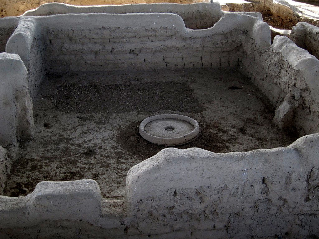
A little beyond Penjikent, close to the border to Uzbekistan is Sarazam, a UNESCO World Heritage Site. Sarazm is an (quote UNESCO) archaeological site bearing testimony to the development of human settlements in Central Asia, from the 4th millennium BCE to the end of the 3rd millennium BCE. The ruins demonstrate the early development of proto-urbanization in this region and are among the oldest in Central Asia. Sarazm demonstrates the existence of commercial and cultural exchanges and trade relations with peoples from the steppes of Central Asia and Turkmenistan, to the Iranian plateau, the Indus valley and as far as the Indian Ocean (quite ends).
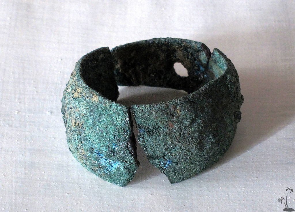
Metallic objects, jewelry and pottery have been excavated. There were domestic, public and cultural buildings. The princess of Sarazm was found here, surrounded by other bodies and rich funeral deposits, indicating a hierarchical social structure of the Sarazm people. The remains of the princess have been moved to the Dushanbe museum.
For all this history and significance to humankind, Sarazm did not leave a big impression on us. The mud foundations of the houses are sunbaked and unrecognizable as such. We even wondered how the mud structures would have remained intact for 5500 years, especially as the gigantic protective tin roofs are of very recent vintage. But perhaps we merely were hungry to fully appreciate the ambiance; and who are we to judge archeological treasures.
| Maximum altitude: | 1552 meter |
| Minimum altitude: | 910 meter |
| Cumulative height: | 1601 meter |
| Cumulative length: | 133 kilometer |
| Difficulty | easy |
| Time: | 1 Day |
| Date of this record | November 2014 |
| Download GPS info: | Zerafshan |
General location and approach: From Aini westwards.
Other Information: If you plan to cross the border to Samarkand, check whether the border crossing has opened.


GPS and trailmaps: The map and trailinformation is generated by ![]() , based on GPS information collected from the actual hike. Waypoints can be downloaded to a GPS device from Wikiloc. If necessary, use GPSBabel to convert GPS data to different formats. For more hike descriptions by Palmtreetreeproduction, browse this website or visit Wikiloc and search for "Palmtreeproduction". You may also find nearby trails from other authors.
, based on GPS information collected from the actual hike. Waypoints can be downloaded to a GPS device from Wikiloc. If necessary, use GPSBabel to convert GPS data to different formats. For more hike descriptions by Palmtreetreeproduction, browse this website or visit Wikiloc and search for "Palmtreeproduction". You may also find nearby trails from other authors.
Google Earth: You may also view the trail in 3D by clicking "view in Google Earth" when on Wikiloc. You need to have Google Earth installed on your computer.