PALM TREE PRODUCTIONS
back to Albania site back to hikes and climbs back to Locations and Travel
Not for a rainy day - behind Gomnit
Mountain![]()
Summary: This trail can be easy, or very difficult. The road from the dam of the Bovilla lake is very beautiful, but some stretches appear to be rarely travelled. Repair work is done, but often by simply moving earth over the washed-away parts, making it a very slippery undertaking on a rainy day! If you travelled the Kruja-Qafe Shtame road and look for some intersting alternative - try this. It is also a good alternative if you want to travel part of the breathtaking Qafe Shtame road, but without going to Burrel and still doing a loop.
| Maximum altitude: | 713 meter |
| Minimum altitude: | 332 meter |
| Cumulative height: | 546 meter |
| Cumulative length: | 13.2 kilometer |
| Difficulty | difficult, when wet |
| Time: | 1.5 hours |
| Date of this record | October 2011 |
| Download GPS info: | Behind Gomnit |
General location and approach: Find your way to Bovilla Lake, the dam behind Zall-Herr. Start at the dam and end at the Qafe Shtame road. At the end of this trail, make up your mind whether to go to Kruja, or continue to Burrel.
Other Information: The trail may be easy or very difficult - depending on the weather. In dry weather, the trail might be "a breeze", though still exposed at times. Also note that a bridge (in October 2011) near the Qafe Shtame road was washed away. While repair work seemed to be underway, and until this is done, it requires some precarious forth-and-back to negotiate the very steep and narrow hairpin curves that lead through a bypass through the river. Better select a sunny and dry day, with plenty of time to spare. Note that you need additional time to complete the journey to Kruja, or Burrel.
GPS and trailmaps: The map and trailinformation is generated by www.wikiloc.org, based on GPS information collected from the actual hike. Waypoints can be downloaded to a GPS device from Wikiloc. If necessary, use GPSBabel to convert GPS data to different formats. For more hike descriptions by Palmtreetreeproduction, browse this website or visit Wikiloc and search for "Palmtreeproduction". You may also find nearby trails from other authors.
Google Earth: You may also view the trail in 3D by clicking "view in Google Earth" when on Wikiloc. You need to have Google Earth installed on your computer.
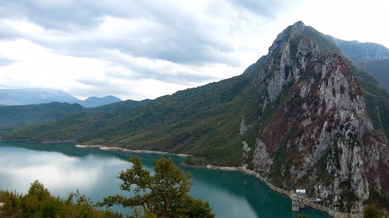
Bovilla Lake, seen shortly after leaving the dam. The steep ridge
belongs to Brar Mountain
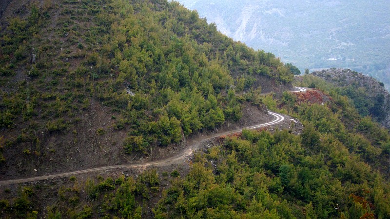
Of course, we didn't take pictures during the height of the action.
But this can give an idea of the difficult travel by car, when it is
wet.
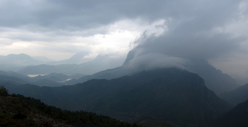
View from the Qafe Shtame road towards the Bovilla Lake. Gomnit
Mountain has the cloud cover, left from it is Brar, and furhther
left in the background is Dajti
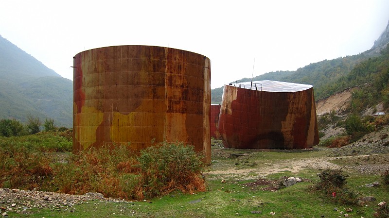
The ominous tanks behind Kruja Mountain