
PALM TREE PRODUCTIONS
Hiking in Colorado, Summers of 2007 and 2008
Click on an image to
see it in full size, or more related images.
Hyperlinked text or images will produce more images or the story of the
related climb.
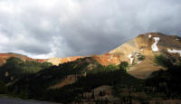
 Front
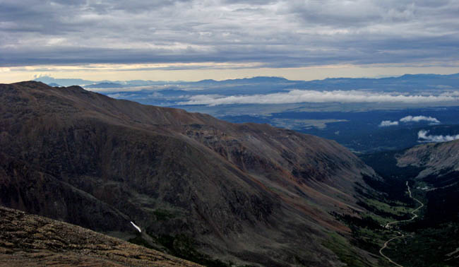
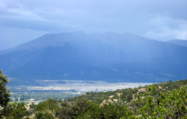
Range North of I-70
Front
Range North of I-70
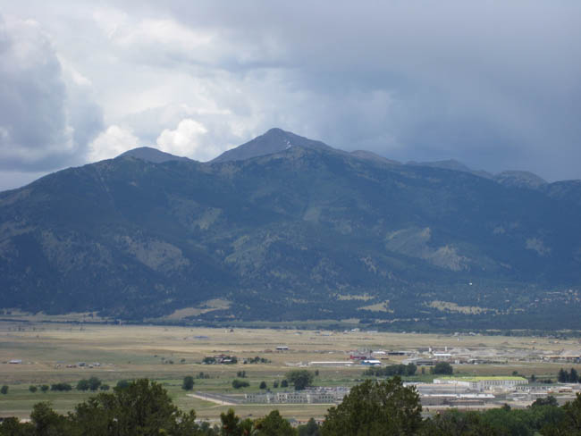
Front Range South of I-70
Tenmile-Mosquito Range
The Sawatch Range
Sangre de Cristo Range
Mesa Verde National Park
San Juan Mountains
Sneffels Range
Elk Range
Index of Mountains Climbed and Covered on this page
Literature
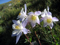
The
Columbine is the state flower of Colorado - and one has ample
opportunity to admire it when hiking or peak-bagging in Colorado.
Click here for shots of the
best flowers in the Colorado Rockies.
Colorado has easily more peaks than one may ever climb in a
lifetime, but the focus tends to go on the 14000 footers, of
 which
there are about 54. There are in fact a few more named summits that
exceed 14000 feet - though their proximity to a higher peak may
preclude them from being counted as such.
which
there are about 54. There are in fact a few more named summits that
exceed 14000 feet - though their proximity to a higher peak may
preclude them from being counted as such.
To climb a Fourteener is never an easy feat, especially when living at sea level and not being adjusted to altitude. It is therefore prudent to start slowly, such as with Squaw Mountain pictured to the left. Squaw Mountain (11,486 feet; climb 500 feet) and Chief Mountain (11,709 feet; climb 1130 feet) sit in the Front Range very close to Denver, which can be seen from their tops if the weather plays along.
Moreover, smaller mountains, or some hike to a remote mountain lake may offer equal enjoyment and more solitude. The lure of the high peaks remains always strong. But, as we learned, Colorado has more to offer for vacation than high mountains that are calling.
Front Range North of I-70
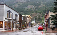 Georgetown is about one hour from downtown Denver, and may not
strike one as an ideal vacation destination. Georgetown is tucked
away in a deep valley right next to the noisy I-70 highway. But, as
many other Colorado mountain towns it has charm, good accommodation,
and nice pubs. At about 8,500 feet, it is also a good first place to
acclimatize to the altitude. It provides an ideal base for many
Front Range mountains north and south of the I-70.
Georgetown is about one hour from downtown Denver, and may not
strike one as an ideal vacation destination. Georgetown is tucked
away in a deep valley right next to the noisy I-70 highway. But, as
many other Colorado mountain towns it has charm, good accommodation,
and nice pubs. At about 8,500 feet, it is also a good first place to
acclimatize to the altitude. It provides an ideal base for many
Front Range mountains north and south of the I-70.
 Mount Woods was recommended as another "quick" acclimatization
hike. Mount Woods has an elevation of 12,940 feet, and requires a
climb of 2,190 feet (if you don't get lost, that is). We had bought
stacks of guidebooks and literature, with very different results....
Mount Woods was recommended as another "quick" acclimatization
hike. Mount Woods has an elevation of 12,940 feet, and requires a
climb of 2,190 feet (if you don't get lost, that is). We had bought
stacks of guidebooks and literature, with very different results....
In 2008, we selected Vasquez Peak as our first acclimatization hike. Relying on a notorious guidebook (Colorado summit hikes for everyone) and without a detailed map, we did get lost - but did have a good time in the Vasquez Peak Wilderness.
back to top back to USA Climbs and Hikes
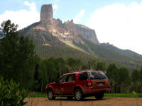
Front Range South of I-70
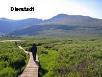
 Mount
Bierstadt is one of the easiest, if not the easiest Fourteener in
Colorado (14,060 feet). From Georgetown, it is a short drive up
Guanella Pass, from which the ascent involves 2,770 feet of
climbing. We had to scale it, because my grandfather's family name
was Bierstedt. Even after three days of altitude adjustment, Mount
Bierstadt still needed will power to finish the climb. From its
summit, Mount Bierstadt offers fine views to Mount Evans.
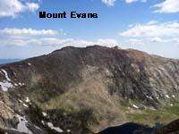
Mount
Evans is not exactly a hikers' destination, due to the road to the
summit.
Mount
Bierstadt is one of the easiest, if not the easiest Fourteener in
Colorado (14,060 feet). From Georgetown, it is a short drive up
Guanella Pass, from which the ascent involves 2,770 feet of
climbing. We had to scale it, because my grandfather's family name
was Bierstedt. Even after three days of altitude adjustment, Mount
Bierstadt still needed will power to finish the climb. From its
summit, Mount Bierstadt offers fine views to Mount Evans.
Mount
Evans is not exactly a hikers' destination, due to the road to the
summit.
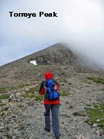 Best
reached from Georgetown is the trailhead to
Grays and Torrey Peaks
(14,270 and 14,267 feet respectively), which are best climbed
together if one is so inclined. Grays and Torreys Peak have the
distinction of being the only Fourteeners right on the Continental
Divide. Which we find quite surprising. Gerry Roach says in his
(excellent) guidebook that the greatest hazard on this route may be
being muzzled by a dog. Which we can confirm having been there on a
Saturday - but it does not detract from a wonderful hike on two
outstanding peaks!
Best
reached from Georgetown is the trailhead to
Grays and Torrey Peaks
(14,270 and 14,267 feet respectively), which are best climbed
together if one is so inclined. Grays and Torreys Peak have the
distinction of being the only Fourteeners right on the Continental
Divide. Which we find quite surprising. Gerry Roach says in his
(excellent) guidebook that the greatest hazard on this route may be
being muzzled by a dog. Which we can confirm having been there on a
Saturday - but it does not detract from a wonderful hike on two
outstanding peaks!
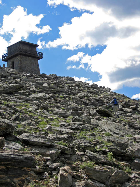
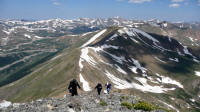 A
great hike away from the crowds is the summit of
Grizzly Peak
(13,427 feet). There are 5 Grizzly Peaks or Mountains in
Colorado. Of those, the Grizzly at the Loveland Pass is easily
accessible and lends itself to a fine hike with views throughout. The walk along the
ridge is entirely above timberline and provides continuous views in
all directions.
A
great hike away from the crowds is the summit of
Grizzly Peak
(13,427 feet). There are 5 Grizzly Peaks or Mountains in
Colorado. Of those, the Grizzly at the Loveland Pass is easily
accessible and lends itself to a fine hike with views throughout. The walk along the
ridge is entirely above timberline and provides continuous views in
all directions.
For a good rest, head no further than Frisco. Two hours away from Denver, Frisco lies in the middle of countless ski resorts and shopping malls, but has maintained a village character and is quite hip.
back to top back to USA Climbs and Hikes
Tenmile-Mosquito Range
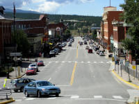
 We
only guess that the Tenmile-Mosquito Range stretches over ten miles
from north to south, but then we cannot confirm any particular
plague. The base for exploring the range is Breckenridge, a chic Ski
resort that offers good value in Summer. Our dining experiences in
Colorado cover the full spectrum from awful to awesome, with
Breckenridge leading by a good margin.
We
only guess that the Tenmile-Mosquito Range stretches over ten miles
from north to south, but then we cannot confirm any particular
plague. The base for exploring the range is Breckenridge, a chic Ski
resort that offers good value in Summer. Our dining experiences in
Colorado cover the full spectrum from awful to awesome, with
Breckenridge leading by a good margin.
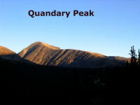 Quandary
Peak (14,265 feet) is the obvious target for collectors of
"Fourteeners" staying in Breckenridge. Not difficult to climb,
Quandary nevertheless requires some stamina. Because it has a long
hike above timberline, weather and lightning can be a problem when
starting too late in the day. Quandary was the only peak where we
got rained out in 2008 - for the last half hour of our descent.
Quandary
Peak (14,265 feet) is the obvious target for collectors of
"Fourteeners" staying in Breckenridge. Not difficult to climb,
Quandary nevertheless requires some stamina. Because it has a long
hike above timberline, weather and lightning can be a problem when
starting too late in the day. Quandary was the only peak where we
got rained out in 2008 - for the last half hour of our descent.
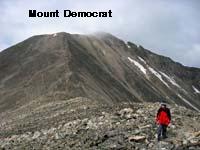
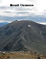
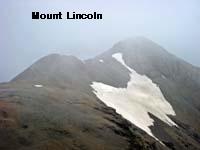
The Tenmile-Mosquito Range has the particular attraction of The Decalibron, which is the roundtrip to Mount Democrat (14,148 feet) , Mount Cameron (14,238 feet), Mount Lincoln (14,286 feet) and Mount Bross (14,172), all in one day. Mount Cameron is not an official Fourteener because the saddle between Cameron and Lincoln is not low enough to properly separate the mountains into two. The Decalibron feat is possible, in theory, because of an early start from the Kite Lake, which offers the highest camping ground in the nation, at 12,000 feet. We did only manage the first two and retreated, for fear of the weather. But an enjoyable tour nevertheless. During the hike, wonderful views open up to Pike Peak.
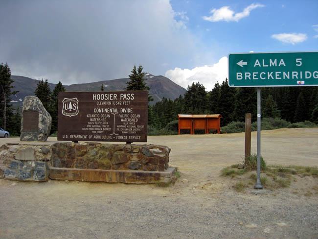
One of the passes on the Continental Divide is the Hoosier Pass, which leads south from the Front Range to the the Tenmile-Mosquito Range.
back to top back to USA Climbs and Hikes
The Sawatch Range
 The
Sawatch Range lies, somewhat simplified, west of Route 24, with
Leadville and its famous Delaware Hotel fairly centrally located.
Even more famous is "Quincy's", which offers Filets Mignon
The
Sawatch Range lies, somewhat simplified, west of Route 24, with
Leadville and its famous Delaware Hotel fairly centrally located.
Even more famous is "Quincy's", which offers Filets Mignon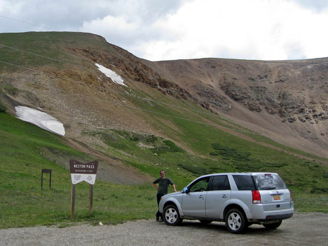 (and nothing else) for $ 7.95 and up. In case you come from east,
you can begin testing your driving skills by taking a
non-high-clearance vehicle (preferrably a rental car!) across the
Weston Pass. Colorado definitely has many off-road or
roads-in-bad-shape challenges, most of which are best explored in
proper 4WD vehicles. Some of the passes can however be managed in
regular saloon cars, provided one has the nerve and time. Leadville
also provides many opportunities for scenic drives or short hikes.
In any case -
Leadwille is one of the highest permanent settlements in the USA
and famous from many western movies...
(and nothing else) for $ 7.95 and up. In case you come from east,
you can begin testing your driving skills by taking a
non-high-clearance vehicle (preferrably a rental car!) across the
Weston Pass. Colorado definitely has many off-road or
roads-in-bad-shape challenges, most of which are best explored in
proper 4WD vehicles. Some of the passes can however be managed in
regular saloon cars, provided one has the nerve and time. Leadville
also provides many opportunities for scenic drives or short hikes.
In any case -
Leadwille is one of the highest permanent settlements in the USA
and famous from many western movies...
 There is wonderful camping to be had, at
Leadville's Turquoise Lake.
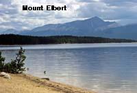
From its shores, you can contemplate (or recover from) climbing
Mount Elbert
(14,433 feet). Mount Elbert is not only the highest mountain of the
Sawatch Range or of Colorado, but of the entire Rocky Mountains.
This provides incentive enough for thousands of people every year
trying their luck. While we indeed met many people climbing Mount
Elbert, trailhead camping was blissfully un-crowded. Even more
dominating is the view (from Turquoise Lake, and generally from
Leadville) of
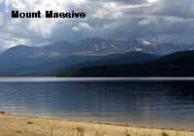
Mount Massive, with 14,421 feet only slightly lower
than Mount Elbert. Mount Massive in indeed massive, and according to
Gerry Roach it has, if cut off at the 14,000 foot mark, the largest
area of any Fourteener in the contiguous United States. The
roundtrip to the summit is 13.6 miles long, with an elevation gain
of 4,450 feet. While not recommended for couch potatoes, it is very
well graded and pleasant hike for the well acclimatized, ambitious
hiker. We wisely followed the usual recommendation for an early
start.
There is wonderful camping to be had, at
Leadville's Turquoise Lake.
From its shores, you can contemplate (or recover from) climbing
Mount Elbert
(14,433 feet). Mount Elbert is not only the highest mountain of the
Sawatch Range or of Colorado, but of the entire Rocky Mountains.
This provides incentive enough for thousands of people every year
trying their luck. While we indeed met many people climbing Mount
Elbert, trailhead camping was blissfully un-crowded. Even more
dominating is the view (from Turquoise Lake, and generally from
Leadville) of
Mount Massive, with 14,421 feet only slightly lower
than Mount Elbert. Mount Massive in indeed massive, and according to
Gerry Roach it has, if cut off at the 14,000 foot mark, the largest
area of any Fourteener in the contiguous United States. The
roundtrip to the summit is 13.6 miles long, with an elevation gain
of 4,450 feet. While not recommended for couch potatoes, it is very
well graded and pleasant hike for the well acclimatized, ambitious
hiker. We wisely followed the usual recommendation for an early
start.
 From
Mount Elbert, one has an excellent view of
La Plata. La Plata is
barely seen from any road or village, but the view from Elbert is
enough to put it on my wish list for the next visit.
From
Mount Elbert, one has an excellent view of
La Plata. La Plata is
barely seen from any road or village, but the view from Elbert is
enough to put it on my wish list for the next visit.
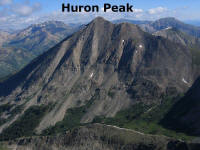 Even
more hidden than La Plata - in fact the most hidden of all
Fourteeners - is shapely
Huron Peak
(14,003 feet) -almost lost in the shuffle of the Sawatch Range, but
nevertheless climbed frequently. It is also the
Fourteener which is the farthest from a paved road. This doesn't say
much, but the dirt road leading to the trailhead is quite something,
at least if you try it in a rented Ford Explorer. Things went well,
though, and Huron turned out to be a very nice hike.
Even
more hidden than La Plata - in fact the most hidden of all
Fourteeners - is shapely
Huron Peak
(14,003 feet) -almost lost in the shuffle of the Sawatch Range, but
nevertheless climbed frequently. It is also the
Fourteener which is the farthest from a paved road. This doesn't say
much, but the dirt road leading to the trailhead is quite something,
at least if you try it in a rented Ford Explorer. Things went well,
though, and Huron turned out to be a very nice hike.
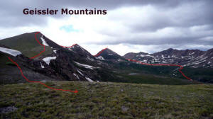 South
of Leadville,
Independence Pass takes one to Aspen, and the drive is
worth it, if more on the Aspen than on the Leadville side. Close to
the top of Independence Pass are the
Geissler Mountains, which lend
themselves to a circuitous route over three peaks, far away from any
crowds.The Geissler Mountains are a actually three peaks (or even
four, depending on guidebook and viewpoint). Because this is a
rim-walk, the accumulated elevation gain is more than initially
meets the eye.
South
of Leadville,
Independence Pass takes one to Aspen, and the drive is
worth it, if more on the Aspen than on the Leadville side. Close to
the top of Independence Pass are the
Geissler Mountains, which lend
themselves to a circuitous route over three peaks, far away from any
crowds.The Geissler Mountains are a actually three peaks (or even
four, depending on guidebook and viewpoint). Because this is a
rim-walk, the accumulated elevation gain is more than initially
meets the eye.
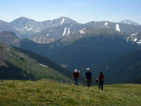
South of the Independence Pass are the "Collegiates", which we did not attempt to climb. Some of them are pictured below, together with Antero, Shavano and Tabugeache. All of them look like great heaps of rubble, and while their summits are lofty without doubt, the long distances and high altitude gains are definitely a deterrent.
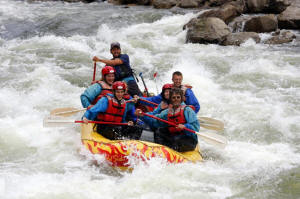
It is difficult to show unfaltering enthusiasm to climb all these mighty Fourteeners. If one would climb any or all of these, one could always relax afterwards in the Princeton Hot Springs (15 Dollar for dipping into the hot pool)...or visit the Castles for a short stint. Even better, go rafting on the Arkansas River!
back to top back to USA Climbs and Hikes
Sangre de Cristo Range
 The
Sangre de Cristo Range is a long, linear (thin) range starting south
of Salida and extending to Santa Fe, New Mexico. The hiker or peak
bagger must make up his or her mind before approaching the range
whether to approach from the east or from the west - because there
is no pass manageable by regular vehicles across the range. We
approached it from the west and ended up, somewhat naturally,
in the
village of Crestone (the only easy Fourteener in the range -
Humboldt Peak - is to be approached from the east). The "Crestone
Range" includes such eminent peaks as Crestone Peak and Crestone
Needle.
The
Sangre de Cristo Range is a long, linear (thin) range starting south
of Salida and extending to Santa Fe, New Mexico. The hiker or peak
bagger must make up his or her mind before approaching the range
whether to approach from the east or from the west - because there
is no pass manageable by regular vehicles across the range. We
approached it from the west and ended up, somewhat naturally,
in the
village of Crestone (the only easy Fourteener in the range -
Humboldt Peak - is to be approached from the east). The "Crestone
Range" includes such eminent peaks as Crestone Peak and Crestone
Needle.
 The
Sangre de Cristo Range is different from the main assemblage of the
Sawatch Range or the Front Range, in that it provides fairly alpine
scenery: peaks with cliffs, mountain lakes, and solitude. We camped
at the North Crestone campground, which is tent campers heaven and
barely utilized, and made a long excursion to
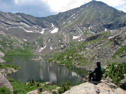
North Crestone Lake
-
a 12 miles roundtrip. The scenery is outstanding - as are the
butterflies we encountered along the way.
The
Sangre de Cristo Range is different from the main assemblage of the
Sawatch Range or the Front Range, in that it provides fairly alpine
scenery: peaks with cliffs, mountain lakes, and solitude. We camped
at the North Crestone campground, which is tent campers heaven and
barely utilized, and made a long excursion to
North Crestone Lake
-
a 12 miles roundtrip. The scenery is outstanding - as are the
butterflies we encountered along the way.
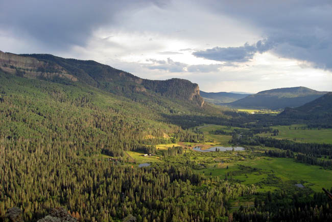
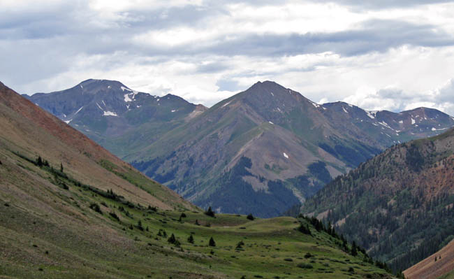
Once we were done with the Sangre de Cristo Range, we headed for the San Juan mountains, and here is a shot from Wolf's Creek Pass along the way.
back to top back to USA Climbs and Hikes
Mesa Verde National Park
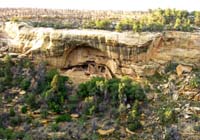 Once
in a while you need a break from hiking and mountaineering, and
Mesa
Verde provides exactly the right attraction. The park sits in the
south-western corner of Colorado, and while it may be subject to the
same afternoon rains as any other mountainous region in Colorado in
July, it remains fairly warm.
Once
in a while you need a break from hiking and mountaineering, and
Mesa
Verde provides exactly the right attraction. The park sits in the
south-western corner of Colorado, and while it may be subject to the
same afternoon rains as any other mountainous region in Colorado in
July, it remains fairly warm.
Plan to spend at least an overnight in Mesa Verde, to take advantage of a few of the tours on offer, to see the cliff-houses of the ancient Pueblo people up-close. You may see a lot by doing a self-guided trip, but as our details show, the tours are well worth it!
back to top back to USA Climbs and Hikes
San Juan Mountains
 The
San Juan mountains are very attractive: very alpine, somewhat
remote, Fourteeners en-masse, many mountain passes for the 4WD
enthusiast, and best of all they are not crowded. Unless you have a
capable 4WD vehicle with high clearance and the right nerve, hiking
in the San Juan's requires some careful planning due to difficult
logistics. Again, you have to decide whether to approach from the
east (route 149, passing through Lake City), or from the west (Route
550). The latter, also called the "Million Dollar Highway" from
Montrose to Durango to is certainly worth taking, though hiking
possibilities (as far as Fourteeners are concerned) are few. The
famous "Chicago Basin" - starting base for several high altitude
hikes - is only reachable by steam train (which is said to require
booking in advance).
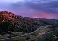
Silverton is quite photogenic, but not exactly
a mountaineer's paradise. The Highway also leads over the
Red
Mountain Pass, past - well the Red Mountain - and many historic
mining places.
The
San Juan mountains are very attractive: very alpine, somewhat
remote, Fourteeners en-masse, many mountain passes for the 4WD
enthusiast, and best of all they are not crowded. Unless you have a
capable 4WD vehicle with high clearance and the right nerve, hiking
in the San Juan's requires some careful planning due to difficult
logistics. Again, you have to decide whether to approach from the
east (route 149, passing through Lake City), or from the west (Route
550). The latter, also called the "Million Dollar Highway" from
Montrose to Durango to is certainly worth taking, though hiking
possibilities (as far as Fourteeners are concerned) are few. The
famous "Chicago Basin" - starting base for several high altitude
hikes - is only reachable by steam train (which is said to require
booking in advance).
Silverton is quite photogenic, but not exactly
a mountaineer's paradise. The Highway also leads over the
Red
Mountain Pass, past - well the Red Mountain - and many historic
mining places.
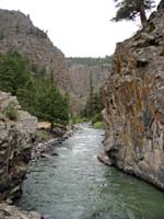 The
fastest way between the the east and west side of the San Juan
Mountains (or between Ouray and Lake City) is via the
Owl Pass, with
its breathtaking views. Also worth mentioning is the
Gateview
Campground on the Gunnison River, which in 2007 we had virtually by
ourselves. Rated justifiably high for tent-campers, it provides good
comfort and stunning scenery. It also provides easy access to
"mediocre weather" tours, such as the hike to the
Powderhorn Lakes.
The
fastest way between the the east and west side of the San Juan
Mountains (or between Ouray and Lake City) is via the
Owl Pass, with
its breathtaking views. Also worth mentioning is the
Gateview
Campground on the Gunnison River, which in 2007 we had virtually by
ourselves. Rated justifiably high for tent-campers, it provides good
comfort and stunning scenery. It also provides easy access to
"mediocre weather" tours, such as the hike to the
Powderhorn Lakes.
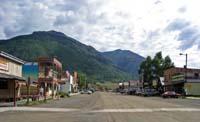
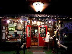 Lake
City is the start of a many hikes to mountains big and small. While
in 2007 we got rained out and didn't care to stay, we were able to
finally discover its charm during our 2008 trip. Especially
noteworthy is the unassuming bakery, which provides an uninterrupted
stream of heavenly out-of-the-oven goods.
Lake
City is the start of a many hikes to mountains big and small. While
in 2007 we got rained out and didn't care to stay, we were able to
finally discover its charm during our 2008 trip. Especially
noteworthy is the unassuming bakery, which provides an uninterrupted
stream of heavenly out-of-the-oven goods.
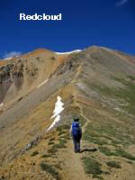
In 2007, we tried our luck with Redcloud (14,034 feet; which we managed) and Sunshine (which we did not, mainly on account of miserably looking weather). Sunshine has the distiction of being, with 14,001 feet, the smallest Fourteener. Close to Redcloud is Handies, another Fourteener on our to-do-list.
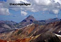
Redcloud offers great views of Uncompahgre (14,309 feet), which was high on our to-do-list for 2008. It is the sixth highest Fourteener in Colorada - and one of the most desired. Few mountains have such a distinct shape, and command such views from their summits. Uncompahgre has a stunning profile and stands high above its surroundings. In spite of its commanding presence, it is not a difficult mountain to climb - provided you have a four-wheel drive that cuts 5 miles off (one way) an otherwise tedious hike. Uncompahgre . View mountains have such a distinct shape, and command such views from their summits. We were lucky to have glorious weather on our hike to Uncompahgre.
back to top back to USA Climbs and Hikes
Sneffels Range
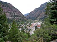 The
Sneffels Range is normally counted as a range separate from the San
Juan Mountains. The main town to access
Mount Sneffels and other
peaks in the range is from
Ouray. Ouray works hard to attract and
keep tourists, which mainly seem to consist of 4 wheel enthusiasts.
Aside, Ouray and vicinity offers many hot springs for the tired
mountaineer.
The
Sneffels Range is normally counted as a range separate from the San
Juan Mountains. The main town to access
Mount Sneffels and other
peaks in the range is from
Ouray. Ouray works hard to attract and
keep tourists, which mainly seem to consist of 4 wheel enthusiasts.
Aside, Ouray and vicinity offers many hot springs for the tired
mountaineer.
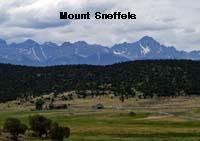 Mount
Sneffels (14,150 feet) is on the top of the to-do list of any
self-respecting hiker in Colorado! Or any collector
of Fourteeners, and comes highly recommended. It is said to be one
of the difficult peaks among the easy Fourteeners, and is certainly
not a walk-up. But then, it is a fabulous mountain and not too
difficult either. The access road is interesting enough (along the
famous shelf-road), and with a high clearance vehicle one can now
drive higher than 12,000 feet, making a climb of Mount Sneffels a
quick half-day jaunt. However, regular hikers like us, with a Ford
Explorer, had to make do from the regular 4x4 trailhead.
Mount
Sneffels (14,150 feet) is on the top of the to-do list of any
self-respecting hiker in Colorado! Or any collector
of Fourteeners, and comes highly recommended. It is said to be one
of the difficult peaks among the easy Fourteeners, and is certainly
not a walk-up. But then, it is a fabulous mountain and not too
difficult either. The access road is interesting enough (along the
famous shelf-road), and with a high clearance vehicle one can now
drive higher than 12,000 feet, making a climb of Mount Sneffels a
quick half-day jaunt. However, regular hikers like us, with a Ford
Explorer, had to make do from the regular 4x4 trailhead.
back to top back to USA Climbs and Hikes
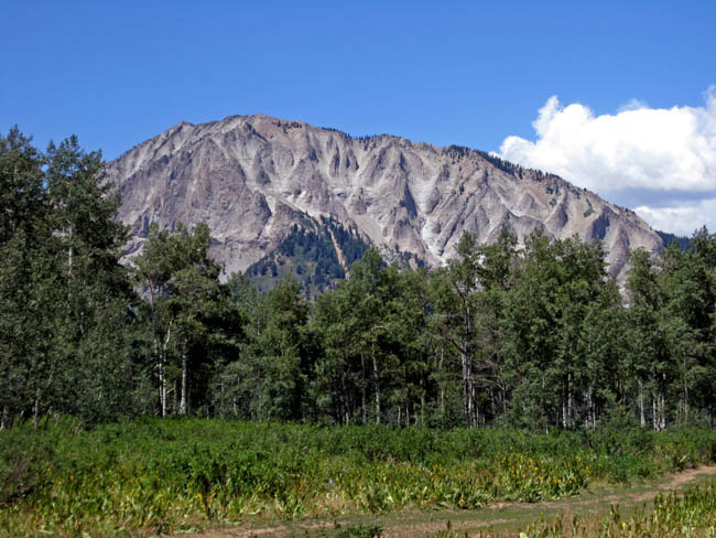
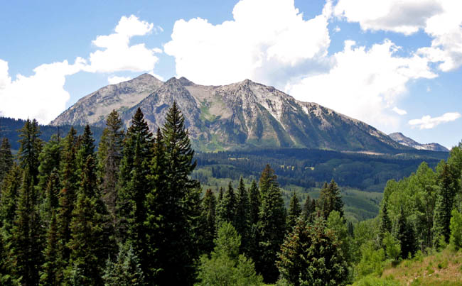
Elk Range
We didn't make plans for the Elk Range (and several other nice regions in Colorado), but while driving through we realized how many more days we could have spent. Beckwith Mountain is probably one of the most photographed mountains, particularly during fall season when the aspen forests turn yellow. While not reaching near the magic 14,000 foot mark, Beckwith is definitely worth a climb. And so are other peaks in the vicinity of the Kebler Pass, connecting Crested Butte with Route 133.
back to top back to USA Climbs and Hikes
Index of Mountains Climbed and Covered on this page
Mount Elbert,
14,433 feet
Mount Massive, 14,421 feet
Uncompahgre Peak, 14,309 feet
Grays Peak, 14,270 feet
Torreys Peak, 14,267 feet
Mount Evans, 14,265 feet
Quandary Peak, 14,265 feet
Mount Sneffels, 14,150 feet
Mount Democrat, 14,148 feet
Mount Bierstadt, 14,060 feet
Redcloud Peak, 14,034 feet
Huron Peak, 14,003 feet
Grizzly Peak (near Loveland Pass), 13,427 feet
Geissler Mountains, 13,301 feet
Woods Mountain, 12,940 feet
Chief Mountain, 11,709 feet
Squaw Mountain, 11,486 feet
Additional trips, locations and tours are described throughout the
page.
back to top back to USA Climbs and Hikes
Literature
We bought a good stack of literature and maps to prepare for the journey. Some books turned out to be good investments, others not. Here's our take:
Gerry Roach: Colorado's Fourteeners - from hikes to climbs: The definitive guide to the Fourteeners, highly accurate and complete, including trailhead access. Each description of peaks includes a details and accurate map.
Scott S. Warren: 100 classic Hikes in Colorado. Nice laid-out guide, and we did a few hikes during our 17 day Colorado vacation. Doesn't include many summit hikes, and diverts you - perhaps justifiably so - to less trodden paths.
Best Summit Hikes in Colorado, 2007. Well written, informative and a pleasure to read. The author, James Dziezynski, is so enthusiastic about hiking and climbing, everything just appears to easy and fun. A fine selection of non-Fourteeners trips; of which many are class 3 scrambles. His suggested times are somewhat erratic - and mostly require far above average stamina, acclimatization and experience. There is the occasional error in the description - take a good map along with you.
Christina Williams: An Altitude SuperGuide - The Best Hikes of Colorado. The 40 hikes are so well described, you don't need to hike them any more. I can't memorize 5 pages of hike description, and I can't read and hike at the same time. I also don't need someone to explain what I see, if I can recognize it for myself when I see it. We didn't use it for a single hike - rather buy it for the bad weather period when you can afford to read.
Dave Muller: Colorado Summit Hikes for Everyone. We bought is because it dawned on us that not all mountains we may want climb are Fourteeners. The format of the book is very practical - two pages with a map - rather a sketch that you expect to see on the back of an envelope. Muller is much into bushwacking - but for this purpose descriptions can be highly inaccurate and misleading. To add insult, Muller - who describes himself as an middle aged man with average fitness levels - adds hiking times ("57 minutes up, 33 minutes down") that can be expected from triathlon gold medalists. Some of his hiking times translate into an average speed of 3.4 miles per hour, and the book should perhaps be titled trail-running for everyone. His selection of mountains is very much slanted to the front range. Use the book to get some idea of what you may want to do, but rely on other data - including other maps - to complete your pre-hike research.
Gil Folsom: Colorado Campgrounds - the 100 best and all the rest. A Gem. Extremely useful and reliable. Takes the guesswork out of camping destinations. Absolutely recommended
Louis Dawson: To Colorado's Fourteeners. Comes in several volumes, contains lots of information, also for snow (winter and spring) climbs and ski descents. Too much information for the average hiker or climber - but excellent if you seek more details on technical climbs.
Dave Covill: Hiking Colorado's summits. We find the title misleading. The selection of summits is by the highest point in each county of Colorado, which includes many cow pastures, and a "suburban street in residential southwest Denver - a short walk from side street parking requiring 5 feet elevation gain". For any other peaks, consult any of the other guidebooks.
Trails Illustrated: Clearly the best maps for whatever area you are in, and quite ubiquitous. I don't like their bulky format, but haven't seen any better. In terms of detail, nothing compares to a "Schweizer Landeskarte".
Colorado Atlas and Gazetteer: We used it quite often to get more accurate bearings for objects in the distance. Each bend and twist in any road is visible. Also, the description of dirt roads (a solid line for passenger cars, a dotted line requiring 4WD) was useful. Not for general car travel, but not bad as good supplement on dirt roads and for peak identification.
There are a bunch of other road maps of varying magnification - collect them all and pick the one you like most.