PALM TREE PRODUCTIONS
back to Albania site back to hikes and climbs back to Locations and Travel
Churches of Ardenica, Libofshe and Shen
Cosmas![]()
Summary:
High
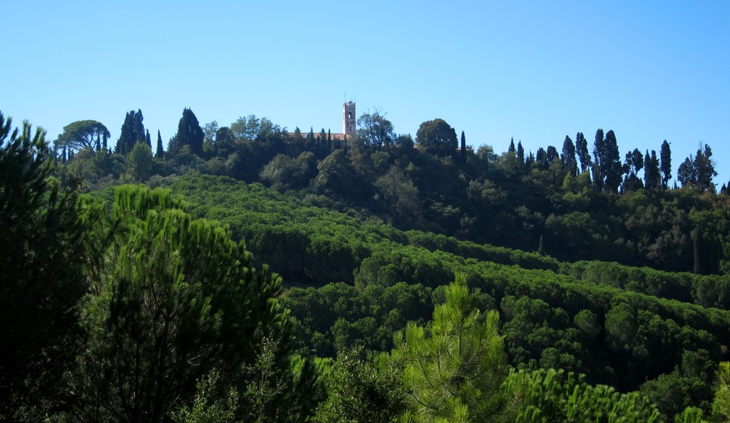
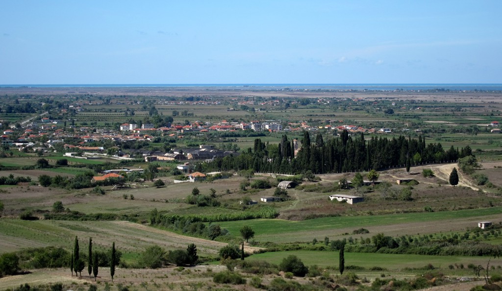
above the lowlands of the fertile Myzeqe between Fier and Lushnje
runs a forested ridge parallel to the
Durres-Vlore
highway. Through the pine tree tops one can have a glimpse of the
church tower of Ardenica.
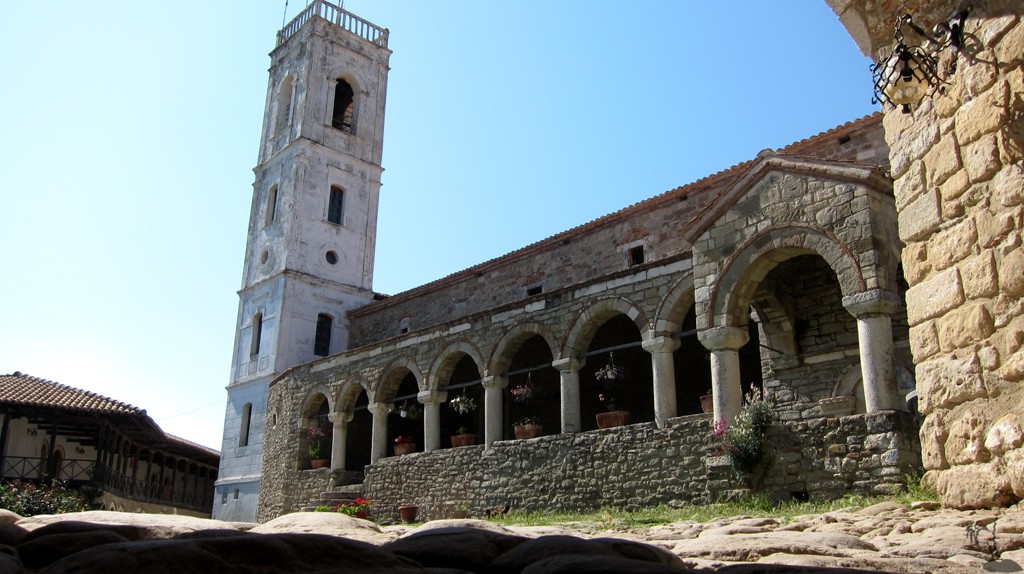
A temple
dedicated to Artemis had existed on the site of the oldest chapel.
The site is about a kilometer away from the Via Egnatia. It is
thought that the name of Ardenica stems from Artemis.
According to
scholars the chapel to the Holy Trinity existed for centuries before
the present large church was built late in the 13th century. The
Byzantine Emperor, Andronikos II Palaiologos started building the
monastery in 1282 after the victory over the Angevins of the Kingdom
of Sicily. The Siege of the Byzantine garrison of Berat by the
Angevins happened in 1280–1281. Berat was a strategically important
fortress, whose possession would allow the Angevins access to the
heartlands of the Byzantine Empire. A Byzantine relief force arrived
in spring 1281, and managed to ambush and capture the Angevin
commander, Hugo de Sully. Thereupon, the Angevin army panicked and
fled, suffering heavy losses in killed and wounded. This defeat
ended the threat of a land invasion of the Byzantine Empire from the
West.
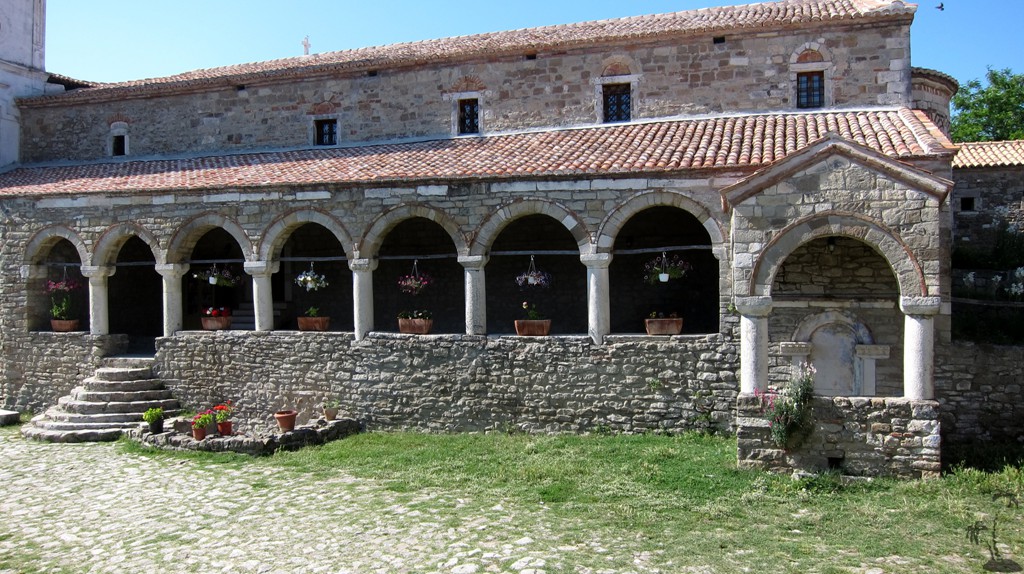
On April 21, 1451
the marriage of George Kastrioti with Andronika Arianiti was
celebrated in the monastery.
From 1780 the
Monastery hosted a Greek school for clerics.
In 1817, the school became a
high school, which had also a student house.
During the Albanian National Awakening period the school
became one of the places where also the Albanian Language was
taught. The monastery had an exceptional library of 32,000 volumes
that got entirely destroyed by a fire in 1932.
The monastery was
closed for the public and for clerical duties in 1969 as the
communist regime declared Albania an atheist state. The buildings
and its surroundings were left in a state of decay for many years
until 1988 when a partial reconstruction took place for touristic
purposes. The Orthodox Autocephalous Church of Albania retook
possession of the monastery in 1992.
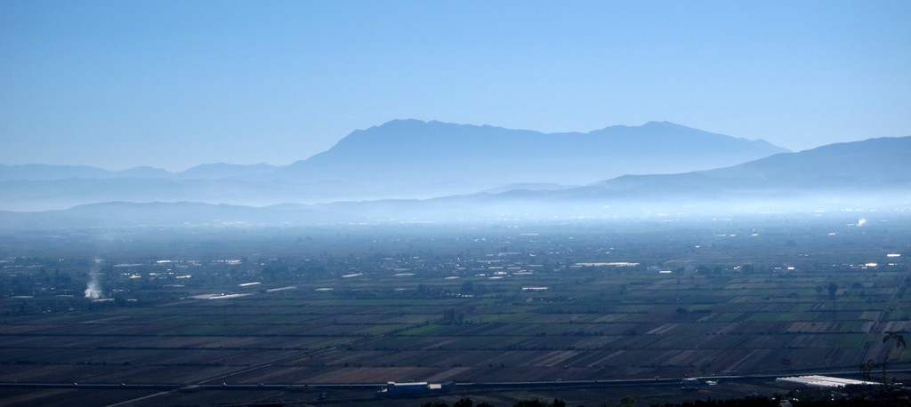
From the hilltop
of Ardenica, one can
see the
white village church of Libofshe, surrounded by its cemetery and a
forest of high cypress trees.
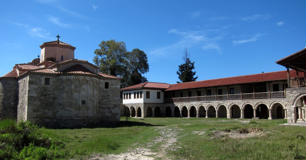
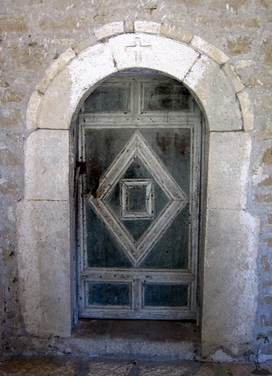
A second
ecclesiastical complex
near Libofshe is
sign posted as St Mary's Monastery. The zig-zag road from Libofshe
leads to the large compound on the banks of the river Seman.
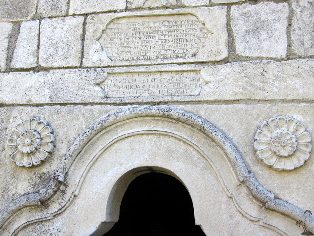
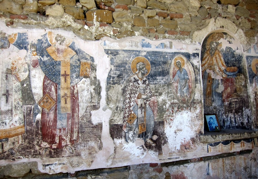
At the site are
two churches in
Romanesque style, St Cosmas and St Mary's. St. Mary has only one
wall left
standing,
with frescoes. St. Cosmas is built around the
grave of St. Cosmas of
Aetolia, a Greek saint of the 18th century, who was martyred for
spreading the faith under the Turkish rule.
A heavily fortified wall and pumps protect the monastery from
the river floods. A guide is on site to explain things – in Ship.
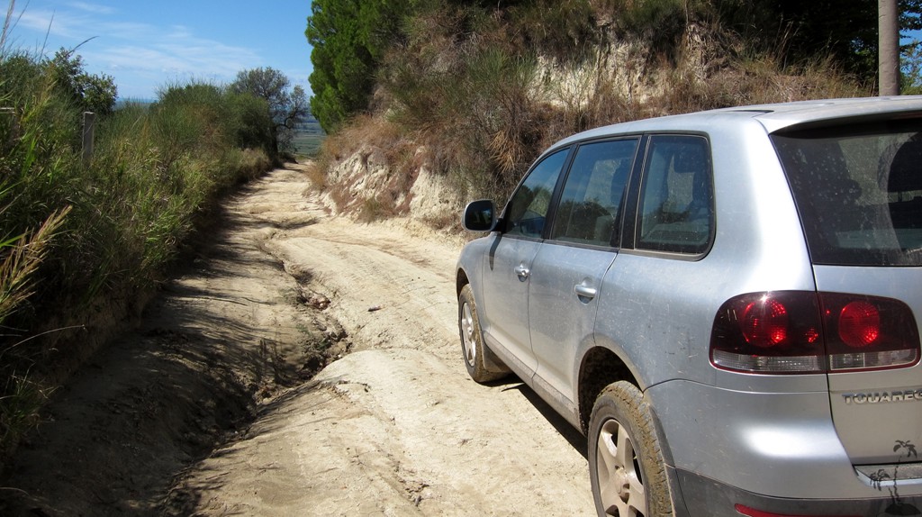
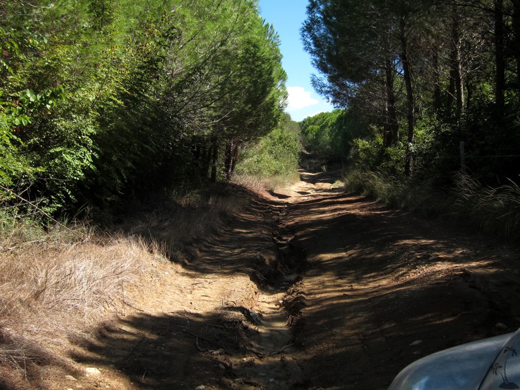
The Drive:
For those who
need to make an adventure out of everything, here is a suggestion
for some very short 4WD excursions from Ardenica.
Take the bus
route on the asphalt road from Kolonje to Ardenica; don’t forget to
visit the church. From the parking lot, continue straight on and
soon turn right at waypoint 2. (You may also continue straight on
the dirt road, though we had to return due to very muddy
conditions). After 500 meter you reach a fork
at waypoint 3
– either way is
possible. We choose a clockwise direction and therefore took the
left fork. After another 2.6 kilometer you reach the asphalt road.
Turn right. After a few hundred meter you reach
waypoint 5 and the
sign to Shen
Marie. It takes almost 3 kilometer to Shen Marie/Shen Cosmas
from there.
Back on the asphalt road,
continue to Libofshe.
After visiting the
church of
Libofshe, drive around
on its right (south) side,
and find your way back to the top Ardenica.
The road is more rutted but
much shorter than
the that you took down from Ardenica.
Alternatively,
return from
Libofshe via
the asphalt road to the highway to Fier.
| Maximum altitude: | 186 meter |
| Minimum altitude: | 3 meter |
| Cumulative height: | 404 meter |
| Cumulative length: | 18.8 kilometer |
| Difficulty | moderate |
| Time: | 1.5 hour |
| Date of this record | September 2013 |
| Download GPS info: | Ardenica |
The asphalt road to Libofshe:
| Maximum altitude: | 178 meter |
| Minimum altitude: | 13 meter |
| Cumulative height: | 182 meter |
| Cumulative length: | 6 kilometer |
| Difficulty | easy |
| Time: | 7 minutes |
| Date of this record | September 2013 |
| Download GPS info: | To Libofshe |
General location and approach: Near Fier

GPS and trailmaps: The map and
trailinformation is generated by
![]() , based
on GPS information collected from the actual hike. Waypoints
can be downloaded to a GPS device from Wikiloc. If necessary, use
GPSBabel to
convert GPS data to different formats. For more
hike descriptions by Palmtreetreeproduction, browse this
website or visit Wikiloc
and search for "Palmtreeproduction". You may also find
nearby trails from other authors.
, based
on GPS information collected from the actual hike. Waypoints
can be downloaded to a GPS device from Wikiloc. If necessary, use
GPSBabel to
convert GPS data to different formats. For more
hike descriptions by Palmtreetreeproduction, browse this
website or visit Wikiloc
and search for "Palmtreeproduction". You may also find
nearby trails from other authors.
Google Earth: You may also view the trail in 3D when viewing it in Google Earth, which you need to have installed on your computer. The 3D perspective allows a good preview of gradients, steepness, possible views and is generally helpful when planning a trip.