PALM TREE PRODUCTIONS
back to Albania site back to hikes and climbs back to Locations and Travel
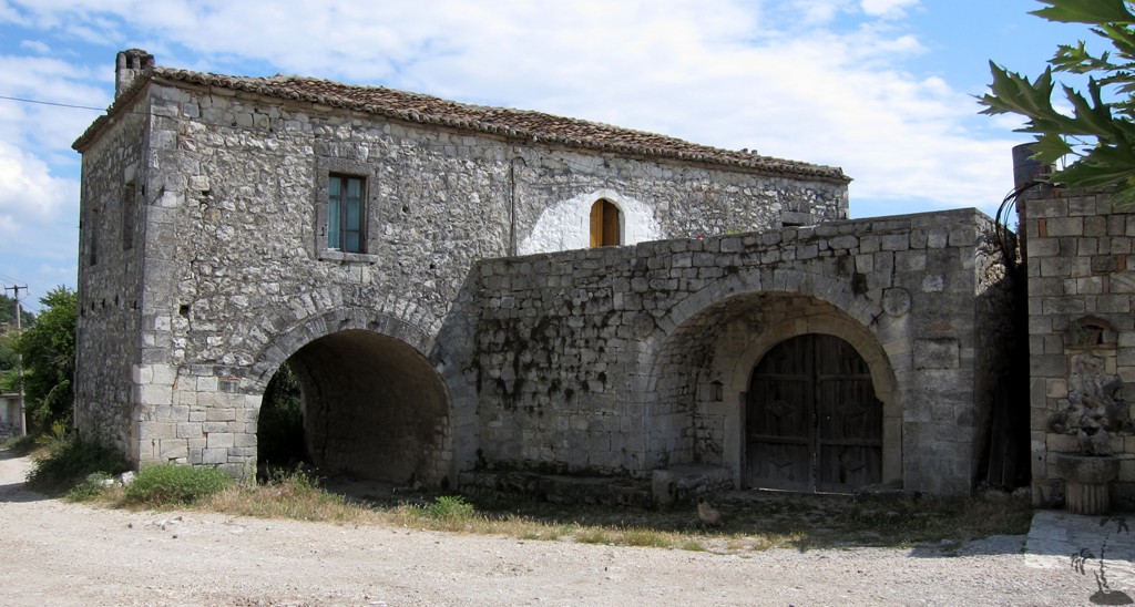
Byllis![]()
![]()
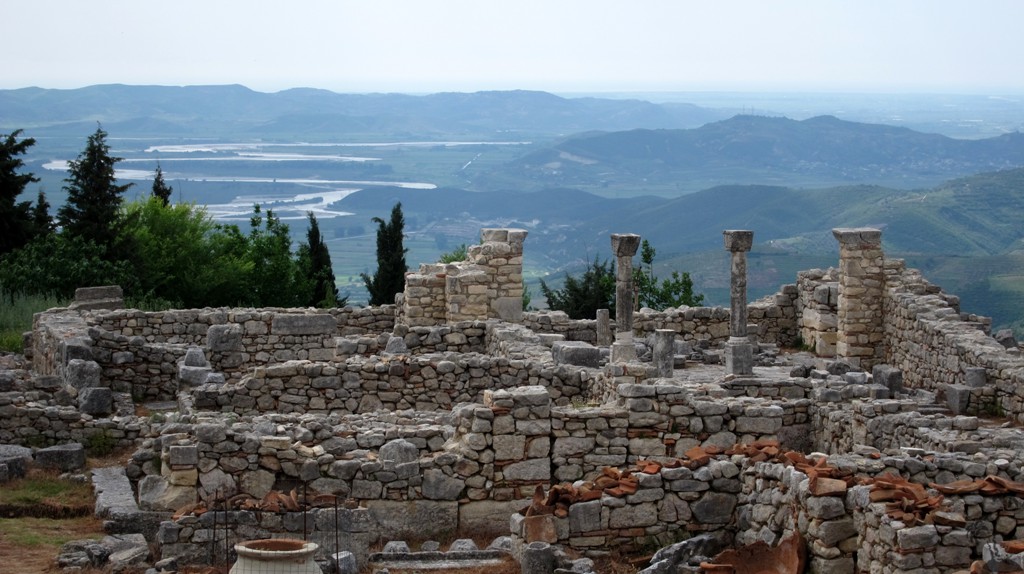
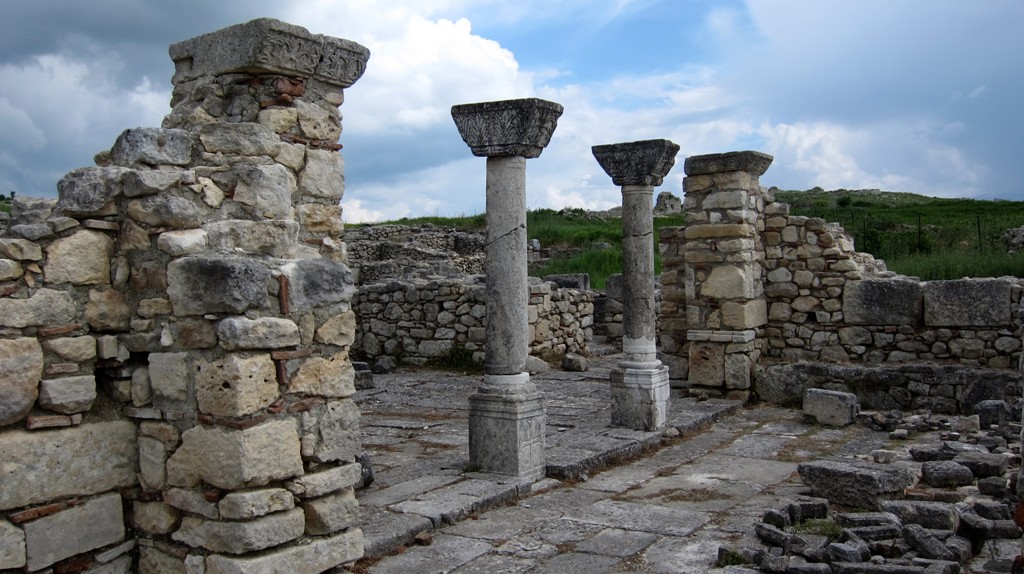
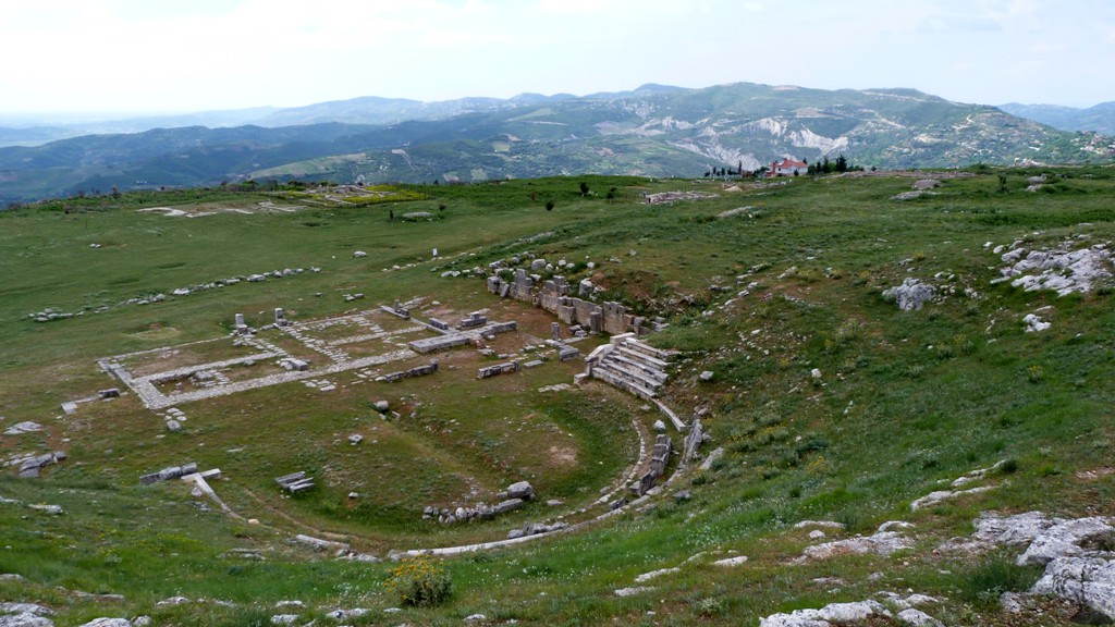
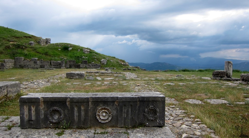
Summary: According to the National Tourism's archeological brochure in its series Albanian Cultural Heritage Byllis has been the largest city in Southern Illyria.
In contrast to other more famous sites it is indeed the majestic size that impresses the visitor first. Even to reach to today’s entrance area, one has to face the wall and go past a precipice along the massive square blocks.
Next to the village of Hekal in Mallakaster an area of 30 ha is walled in by 2.250 m of well preserved stone construction of 8-9 m height and almost 3.5 m width. It was built in the second quarter of the fourth century B.C.
This city was governed by an annual council of civil servants and had its own bronze coins since the 3rd century B.C, competing with the older Apollonia in the coastal lowlands. It became a Roman colony during the first years of the dominion of Augustus.
Access: The usual approach to Byllis used to be from Fier, by driving to and through Ballsh, and turning off the main road shortly after Ballsh to Byllis . The road to Ballsh and onwards got all but destroyed by heavy trucks over the years. Instead the new highway connecting Levan (near Fier) and Gjirokaster has become a great alternative - except that it is so far lacking a decent road - and signboards - for those wishing to visit Byllis. For some time to come, the roads from the new highway through either Hekal or Klos are more for the adventurous. The road to Hekal could be done in a not-so-low lying regular car, for the road via Klos we recommend a 4WD. If you want to drive the loop, we recommend to go up via Klos, and down via Hekal, for the better views.
From the highway, the turn off to Hekal is well signposted.The turn to Klos is signposted wrongly. DO NOT TAKE IT. Instead, the dirt road to Klos turns off from the highway about 100 Meter west (direction of Fier) of the signposted turn. It is a rather small road. The (bigger) dirt road signposted as leading to Klos actually goes to Karburanti and Ballsh as explained below.
We discussed the situation with some villagers from Klos. They were well aware of the wrong road sign, but didn't consider it a concerning issue as the signs to their village had been put up by somebody else.
| Maximum altitude: | 503 meter |
| Minimum altitude: | 31 meter |
| Cumulative height: | 489 meter |
| Cumulative length: | 15 kilometer |
| Difficulty | easy |
| Time: | 40 minutes plus time to visit Byllis |
| Date of this record | September 2013 |
| Download GPS info: | Byllis |
Alternative access: The regular drive (or bus route) to Byllis is via Ballsh. Coming from Ballsh, drive through the town, up the next hill, and find signboards to Byllis there.
The track shown below also includes an easy stretch from the new highway, where a turn off is signposted for Klos. This turn is a dirt road, but it does not go to Klos. Instead, after some pleasant drive for a few kilometers, the dirt road will join the old Ballsh road in a place called Karburanti (there is indeed a gas station at the junction, but we believe the name Karburanti originally stemms form the fact that the area used to be an oil field). Turn left to go into the direction of Ballsh. Don't miss the signpost for Byllis, before you reach Ballsh.
| Maximum altitude: | 400 meter |
| Minimum altitude: | 51 meter |
| Cumulative height: | 556 meter |
| Cumulative length: | 23 kilometer |
| Difficulty | easy |
| Time: | 1 hour |
| Date of this record | September 2013 |
| Download GPS info: | Byllis via Ballsh |
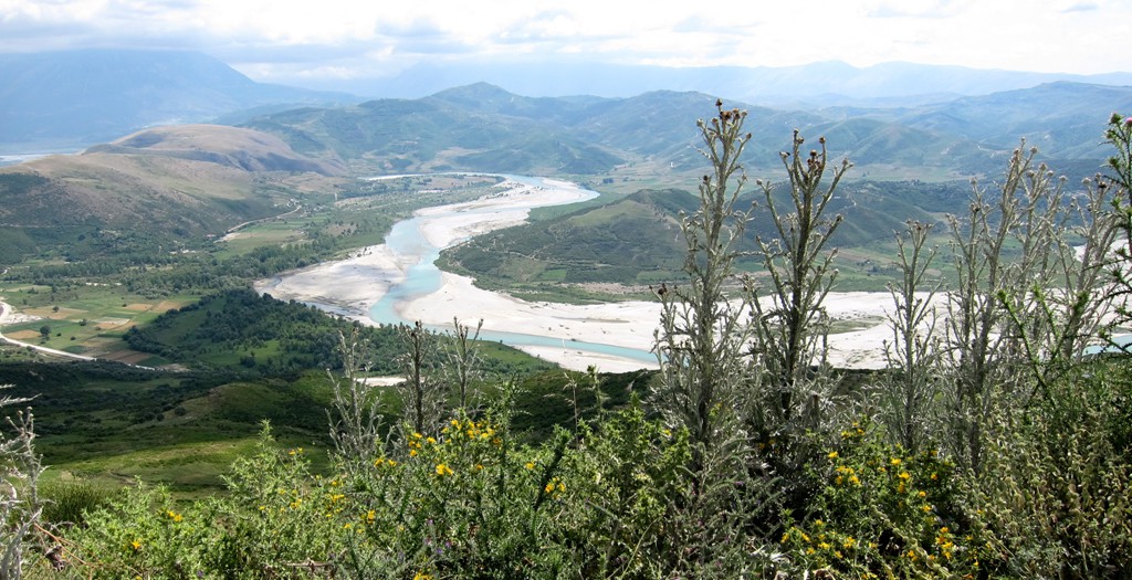
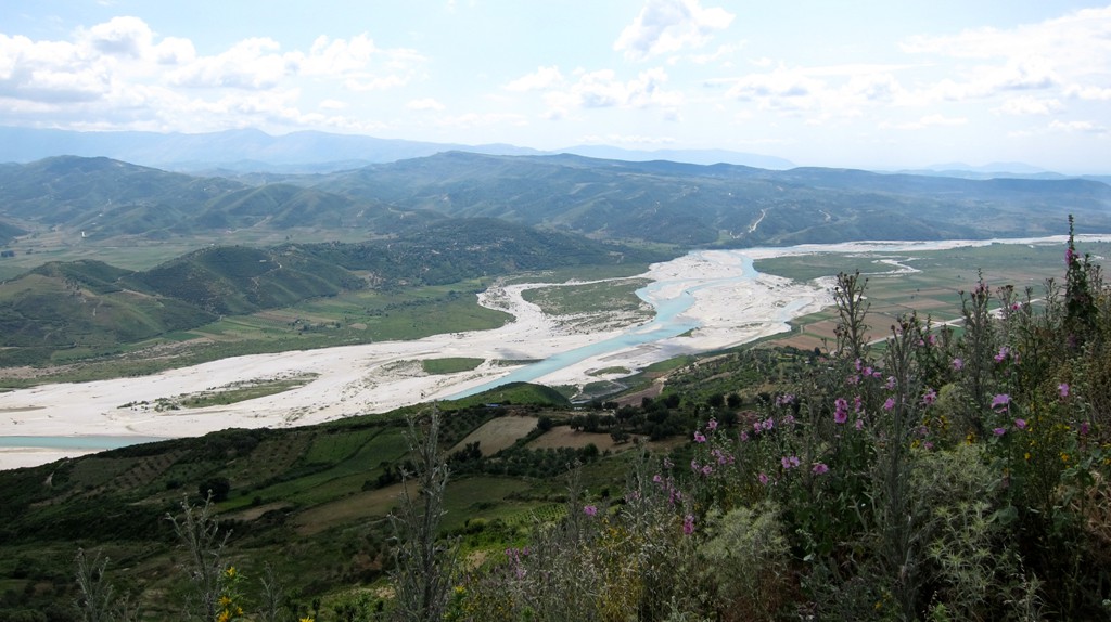
General location and approach: South of Ballsh, near the new Fier - Gjirokaster highway
Other Information: There is a cafe and restaurant at the archeological site. It is advisable to wear strong shows, as the paths in Byllis are rarely maintained, and thristels can be a pain


GPS and trailmaps: The map and
trailinformation is generated by
![]() , based
on GPS information collected from the actual hike. Waypoints
can be downloaded to a GPS device from Wikiloc. If necessary, use
GPSBabel to
convert GPS data to different formats. For more
hike descriptions by Palmtreetreeproduction, browse this
website or visit Wikiloc
and search for "Palmtreeproduction". You may also find
nearby trails from other authors.
, based
on GPS information collected from the actual hike. Waypoints
can be downloaded to a GPS device from Wikiloc. If necessary, use
GPSBabel to
convert GPS data to different formats. For more
hike descriptions by Palmtreetreeproduction, browse this
website or visit Wikiloc
and search for "Palmtreeproduction". You may also find
nearby trails from other authors.
Google Earth: You may also view the trail in 3D when viewing it in Google Earth, which you need to have installed on your computer. The 3D perspective allows a good preview of gradients, steepness, possible views and is generally helpful when planning a trip.