PALM TREE PRODUCTIONS
Road Trip:
Malawi-Namibia-Botswana-Zimbabwe-Malawi
This page is about a self-drive overland trip from Malawi to the Victoria Falls, to Namibia through the Caprivi-strip, the Etosha National Park, Skeleton Coast, the Namib Desert, and back through Botswana and Zimbabwe to Malawi. This is one of the “classical” tours in southern Africa, and definitely worth it. We did it in 1994, but not much has changed since.
Click on an image to see it in full size.
Or click here to see the trip as full-screen picture-story
Shortcuts to: Victoria Falls, Caprivi strip, Etosha National Park, To the Skeleton Coast, Swakopmund, Sosussvlei, Namib-Naukluft, Okavango Delta, Chobe National Park, Zimbabwe
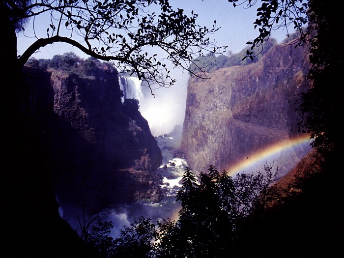
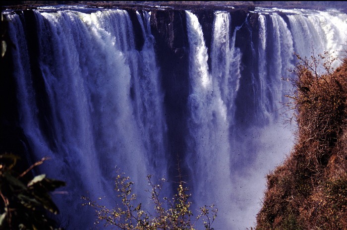
Victoria Falls
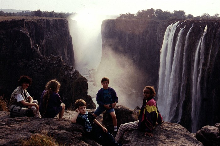
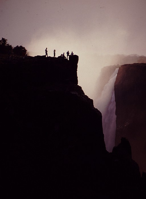 Many travelers start their southern Africa trip at the Victoria
Falls. They also undertake the trip in the European summer, which is
of course winter time on the southern Hemisphere. This makes the
nights longer for stargazing. It also makes the sun more bearable
and the temperatures pretty cold – that’s why you will see us more
often with pullover’s than with swimming costumes.
Many travelers start their southern Africa trip at the Victoria
Falls. They also undertake the trip in the European summer, which is
of course winter time on the southern Hemisphere. This makes the
nights longer for stargazing. It also makes the sun more bearable
and the temperatures pretty cold – that’s why you will see us more
often with pullover’s than with swimming costumes.
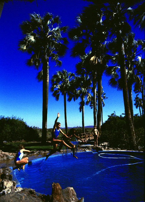
Victoria Falls is worth a visit both from the Zambian side, and the Zimbabwean side. And while you cross from one side to the other, you nowadays can try bungi-jumping, are white water rafting down the Zambezi River, amidst crocodiles and hippopotami.
Caprivi Strip
 After a short drive through Zimbabwe and an even shorter drive
through Botswana, one enters the Caprivi-strip in Namibia. The
Caprivi strip is a geographic anomaly, created through a colonial
desire to connect Namibia to the Zambezi River – and hence to
construct a route to the Indian Ocean. It’s definitely worth to get
out of Katima Mulilo, and stay in one of the better lodges on the
Zambezi River or the Lianshulu.
After a short drive through Zimbabwe and an even shorter drive
through Botswana, one enters the Caprivi-strip in Namibia. The
Caprivi strip is a geographic anomaly, created through a colonial
desire to connect Namibia to the Zambezi River – and hence to
construct a route to the Indian Ocean. It’s definitely worth to get
out of Katima Mulilo, and stay in one of the better lodges on the
Zambezi River or the Lianshulu.
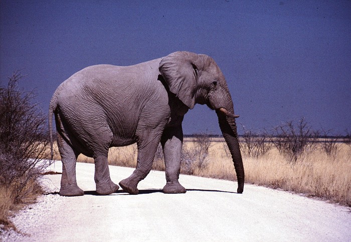
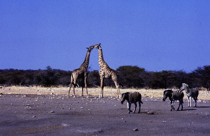
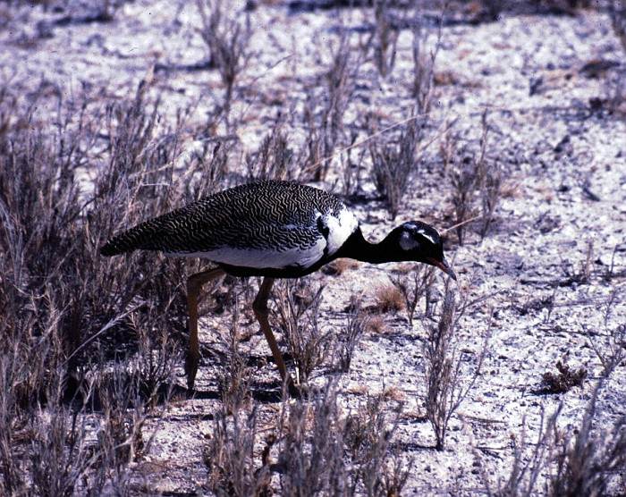
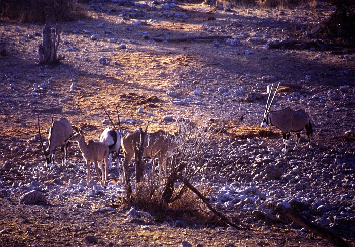
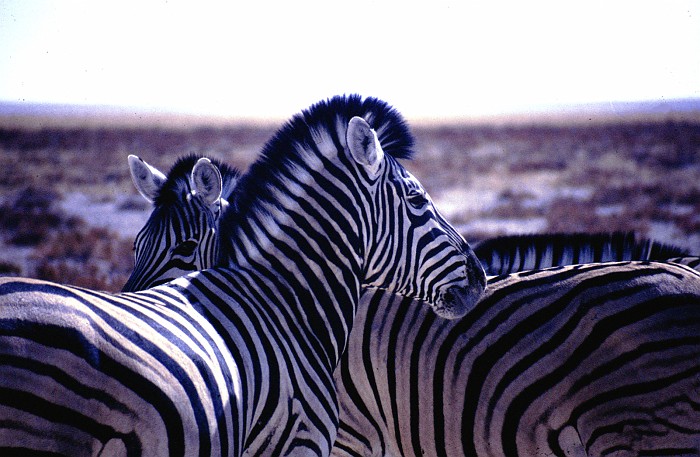
Etosha National Park
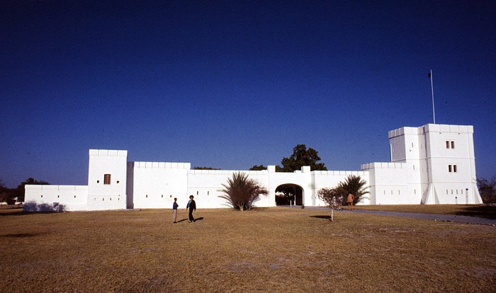
 Fort Namutomi is the western gateway to the Etosha pan and
National Park. Unlike in national parks in eastern Africa, such as
in Kenya and Tanzania, the visitor does not have to drive through
the thicket in the hope to spot an animal. The Etosha pan is wide
open, and dry – at least in the dry season. Animals and visitors
simply meet at the waterholes, which are kept open with water all
year round, and some of which are conveniently lit with spotlights
in the night. Moreover, nowhere in the Etosha park does one have to
fear getting lost – the roads are as good as they get.
Fort Namutomi is the western gateway to the Etosha pan and
National Park. Unlike in national parks in eastern Africa, such as
in Kenya and Tanzania, the visitor does not have to drive through
the thicket in the hope to spot an animal. The Etosha pan is wide
open, and dry – at least in the dry season. Animals and visitors
simply meet at the waterholes, which are kept open with water all
year round, and some of which are conveniently lit with spotlights
in the night. Moreover, nowhere in the Etosha park does one have to
fear getting lost – the roads are as good as they get.

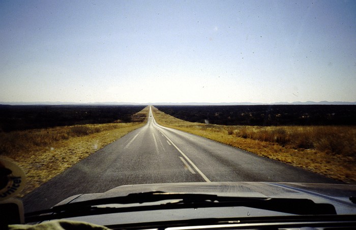
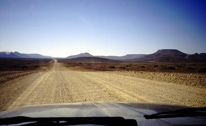
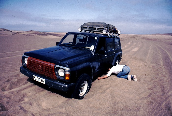
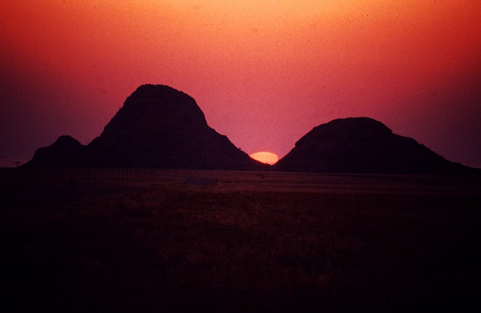
To the Skeleton Coast
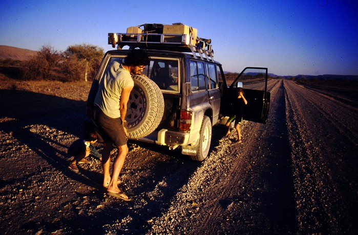
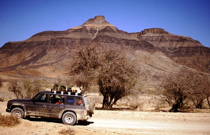
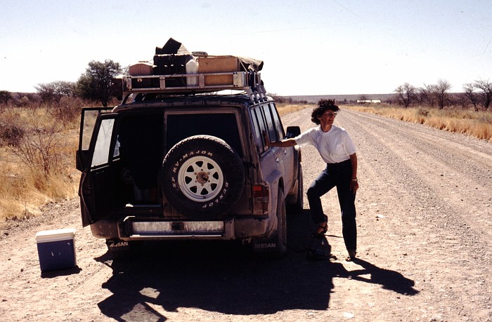
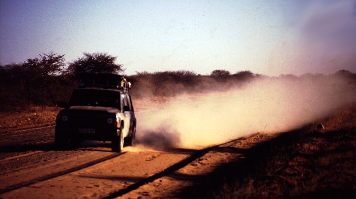
Speaking of roads – Namibia, and southern Africa in general – are the automobilist’s dream – if you like driving straight, that is. Both paved and unpaved roads stretch for hundred of miles, without a village or people in sight. Which doesn’t mean that all is fine – the gravel roads, especially with a car loaded up with people and camping gear for several weeks, eat tires. Before setting off, not only try to change tires, but also to repair them. Also, long stretches of straight road have caused many drivers to veer off, often with fatal consequences.
Palmwag Lodge is one of those welcome stopovers, half way between the dusty Etosha Pan and the cold Skeleton Coast.
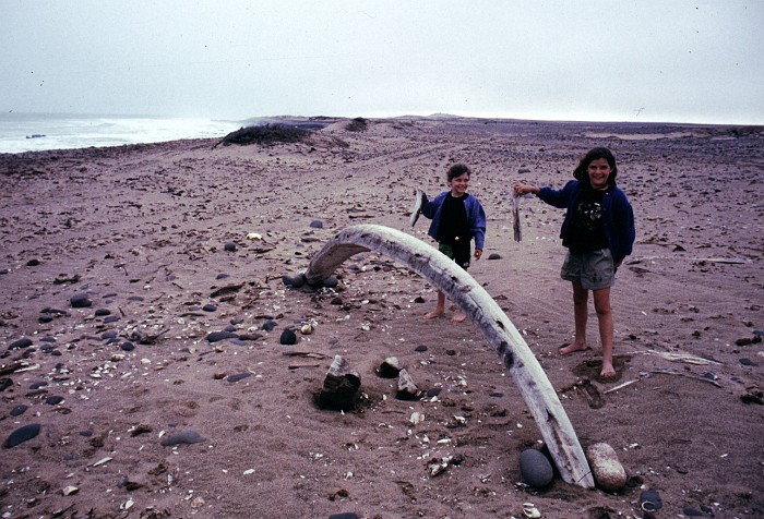
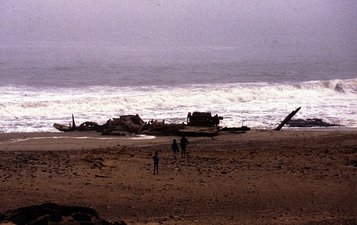
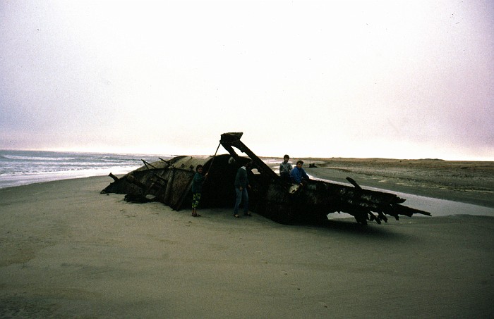
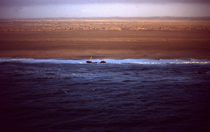
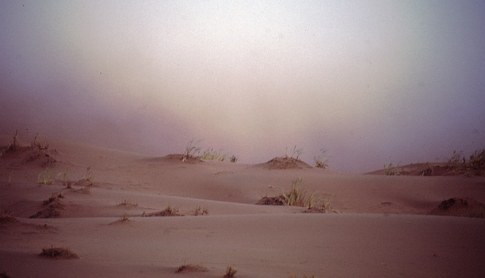
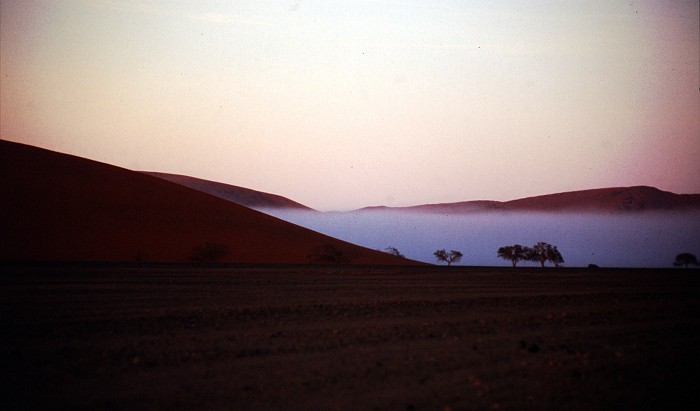
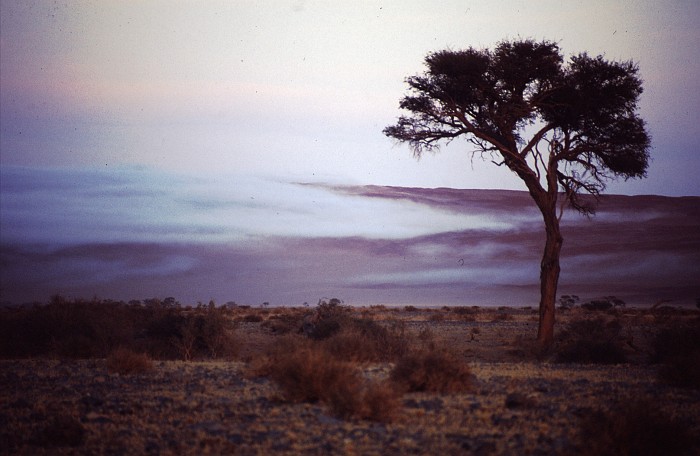
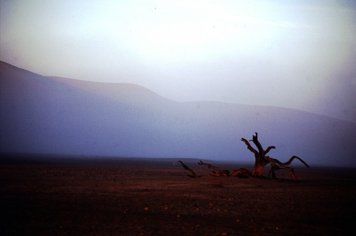
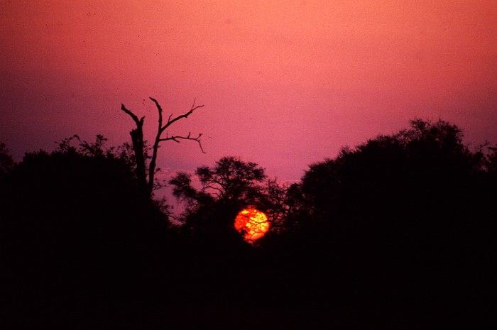
At first sight, the Skeleton Coast is a giant playground, for men and their toys.

But then the Skeleton Coast is exactly this: cold, dark, foggy, littered with bones and shipwrecks and utterly inhospitable.

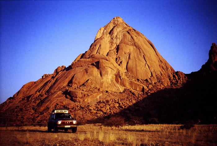
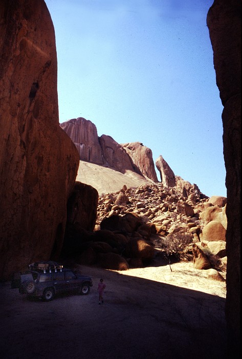
The Spitzkoppe – or Namibia’s Matterhorn – looks particularly picturesque in the afternoon sun. The climb to the top is reserved for those who know what they are doing.
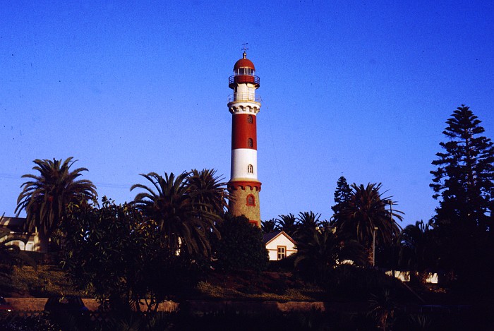
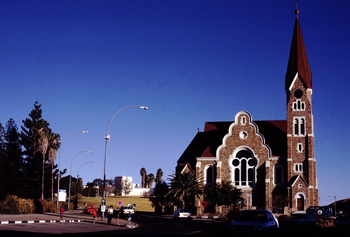
Swakopmund
Swakmund, the most German of all Namibia towns, pitched between the desert and the Atlantic Ocean. More often than not, the town is covered in the coastal fog. Nevertheless, the town has developed as a modest adventure-sports centre, offering anything from scenic flights, dune-boarding, motor-biking, four-wheeling, kite-flying, horse-riding, camel-riding, and whatever comes to one’s mind.
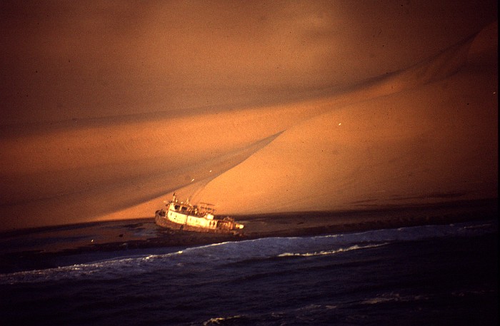
South of Swakopmund and Walvis Bay the Skeleton Coast continues. The shipwrecks are only visible from the air, unless one is ready to walk for a considerable distance.

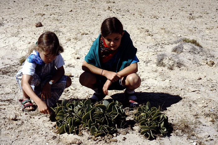
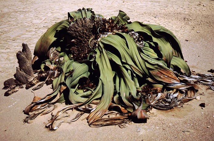
Also near Swakopmund is the Welwitschia Plain. Here grows the Dollarbush, and the Moon Landscape is close by. Welwitschias, one of the oldest living species on earth, are found everywhere along the Skeleton Coast. They live off the fog, and one is not supposed to walk near as the weight of the footsteps compacts the soil around the plant and prevents the absorption of moisture.
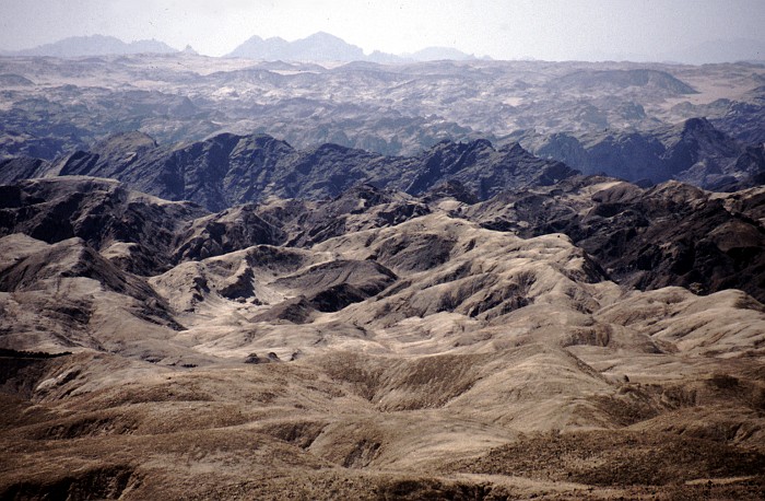
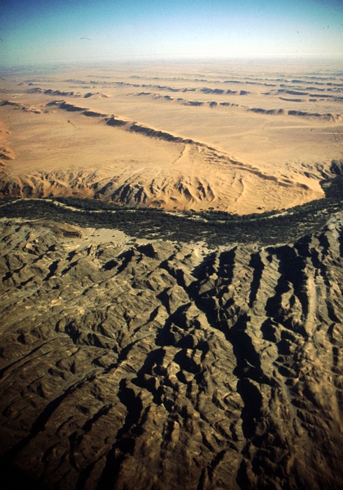
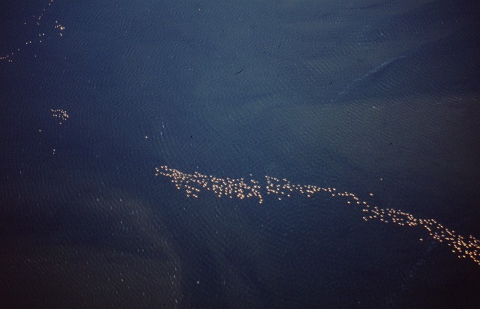
 From Swakopmund one usually travels along the Kuiseb Canyon,
towards Sosussvlei, the site of the big dunes. The Kuiseb Canyon
plays an important role in Namibia’s ecology. The Canyon runs from
east to west. As the sand of the Namib is blown northwards, it falls
into the canyon, and the annual flow of the Kuiseb River takes it to
the Atlantic ocean. As can be seen from the aerial shot, the land
north of the canyon (in the lower half of the picture) is not
covered in sand.
From Swakopmund one usually travels along the Kuiseb Canyon,
towards Sosussvlei, the site of the big dunes. The Kuiseb Canyon
plays an important role in Namibia’s ecology. The Canyon runs from
east to west. As the sand of the Namib is blown northwards, it falls
into the canyon, and the annual flow of the Kuiseb River takes it to
the Atlantic ocean. As can be seen from the aerial shot, the land
north of the canyon (in the lower half of the picture) is not
covered in sand.
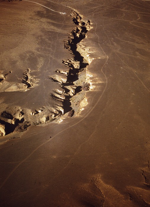
Anoher interesting shot shows the Sesriem Canyon. When visiting, and climbing into the Canyon, one is left with the impression of being in a mountainous area. This shot shows that the Sesriem Canyon is nothing but a crack in the desert plain.
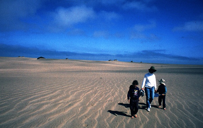
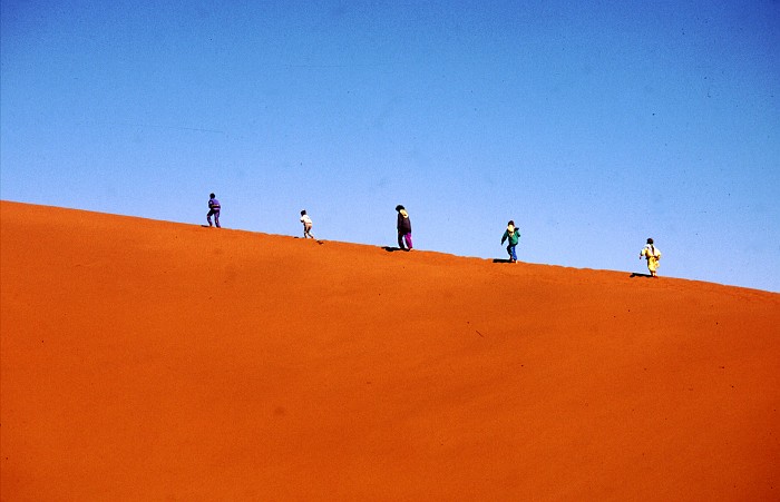
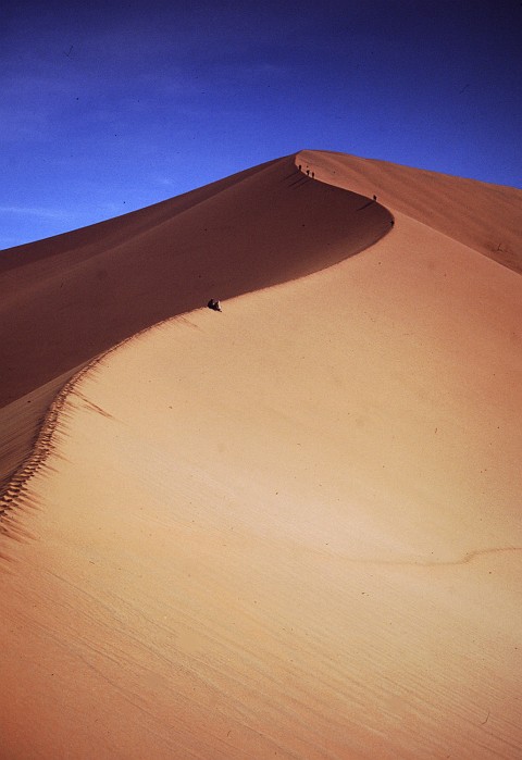
Sosussvlei
And finally at Sosussvlei.
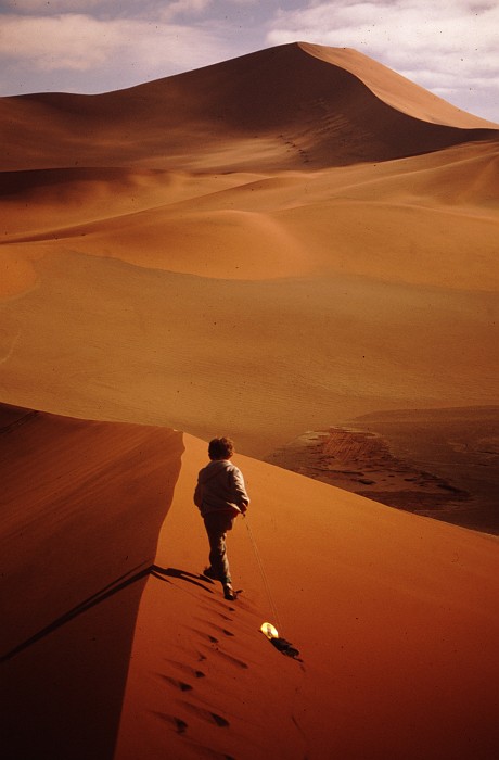
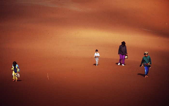
One is well advised to leave early from the campsite at Sesriem, firstly, in order to get the famous sunrise over the dunes. Secondly, to catch a view of the lifting fog. Thirdly, to get the best photo-light. And lastly and most importantly, to beat the trek of other visitors who otherwise happen to be your viewfinder. Otherwise, just take the next-best dune for your walks.


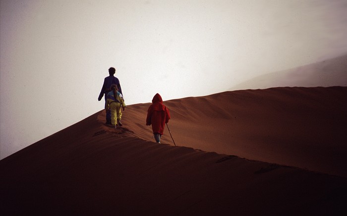
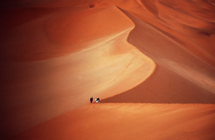
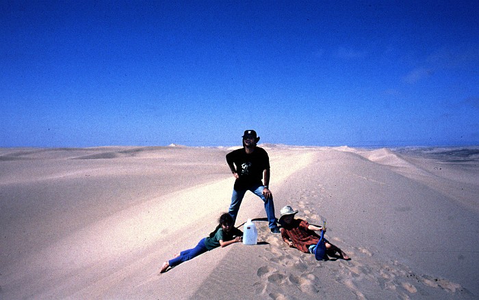
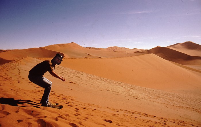
And don’t forget to take refreshments, once you are at the top. My experiment with skiing down (on Austrian “Firn-Gleiter”) the dunes did not meet with positive results. The Gleiter henceforth served as dog-on-the-leash for Tobi.
Namib-Naukluft
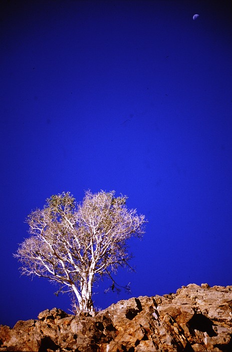
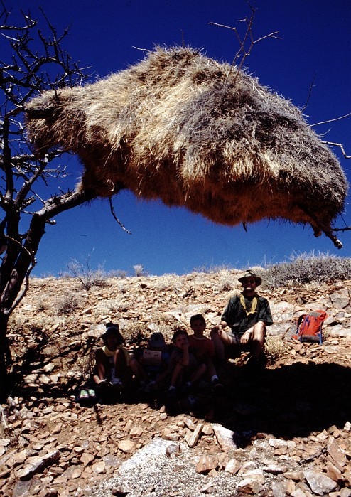
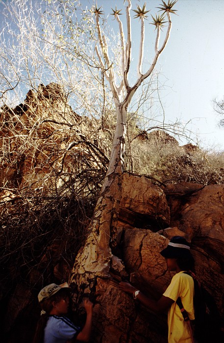
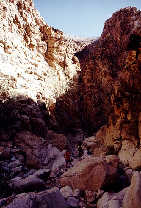
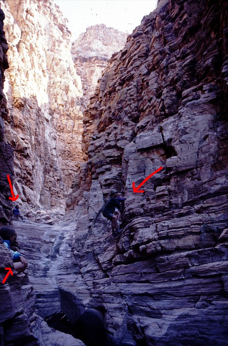
The Namib-Naukluft Park is big, and its eastern parts offer a lot of activity for the intrepid hiker, excellent camping sites, and excellent swimming holes. And, as usual, once you are away from the coastal strip, the sky is as blue as ever.

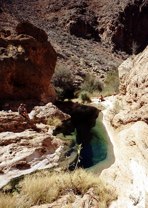
Here we are on the “Olive Trail”, a rugged undertaking that culminates in some interesting climbing.
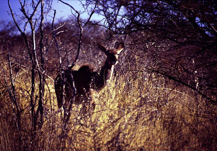
Okavango Delta
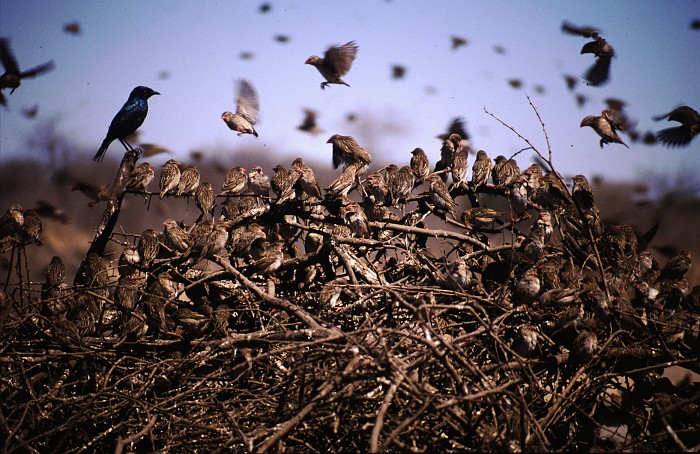
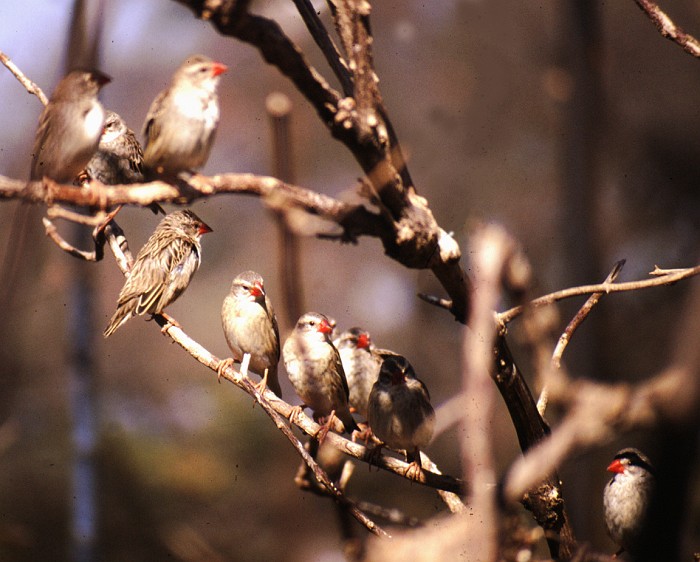
Next destination was Moremi National Park, near Maun in Botswana. First we have to cross a stretch of Kalahari. These days the road connecting Maun and Windhoek is fully paved. On the way we saw these Red-billed Queleas (Quelea quelea). The Red-billed Quelea is the world's most abundant bird species, with an estimated adult breeding population of 1.5 billion.
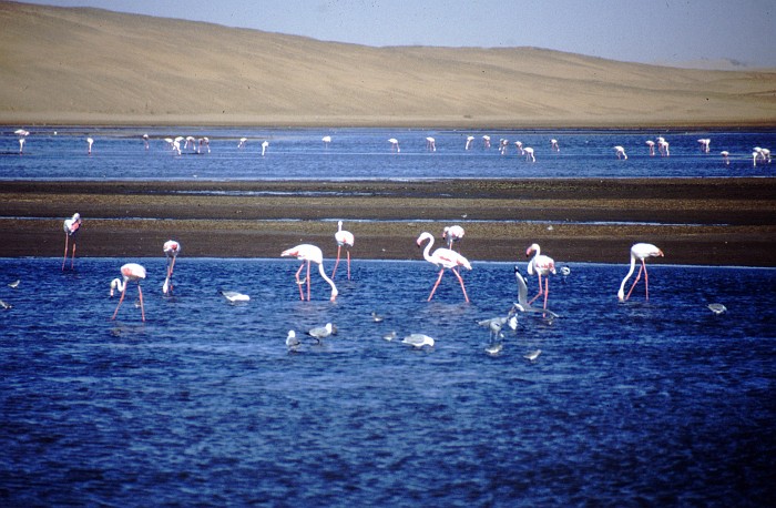
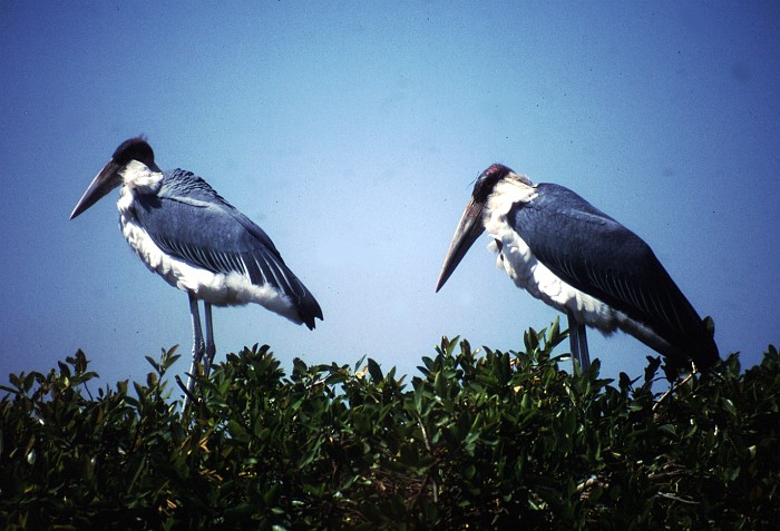
The Moremi Park sits on the Okavango Delta – the place where the Okavango River, coming from Angola, disappears into the sands of the Kalahari. The Park consists of many tiny islands sitting in the shallow, and crystal clear waters of the delta. Many places are only accessible by Mokoro (traditional canoe) or by small aircraft.
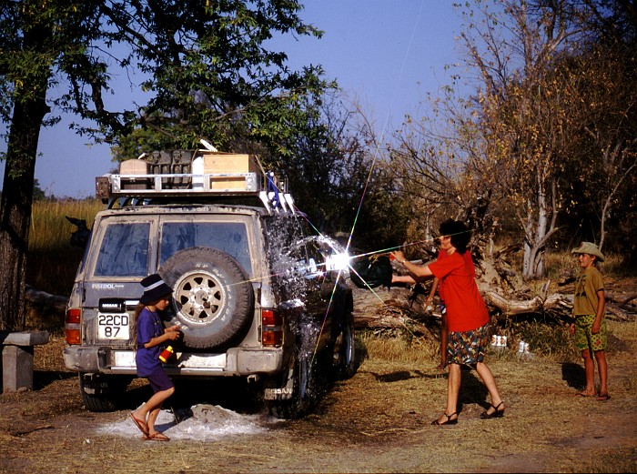
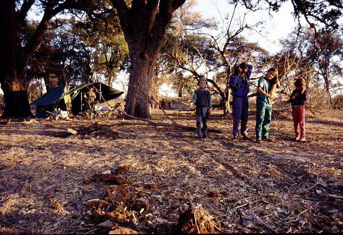
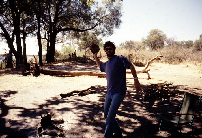
Here are Maryan, Tini, Josi, Tobi sitting at the edge of the swamp waiting for things to happen, while Gabi takes care of the car.
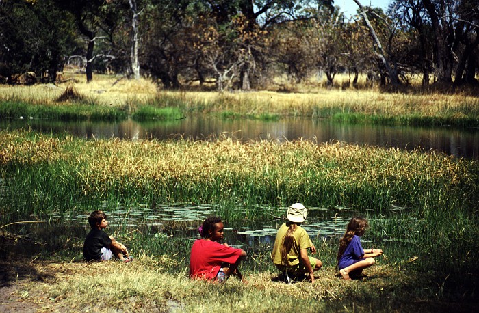
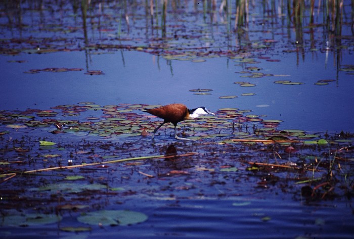
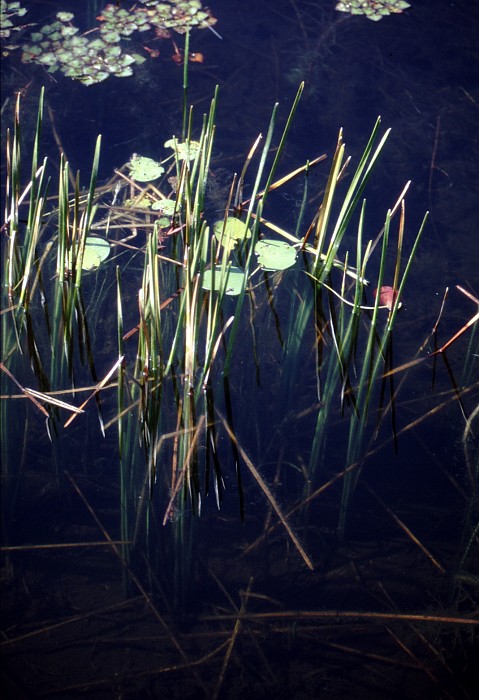
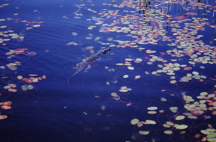
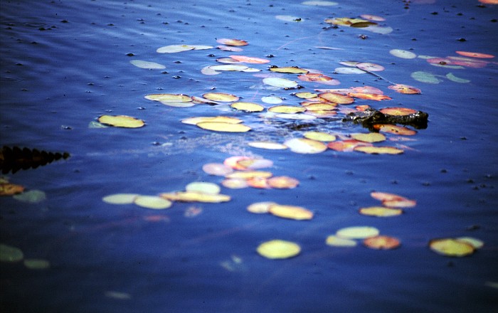
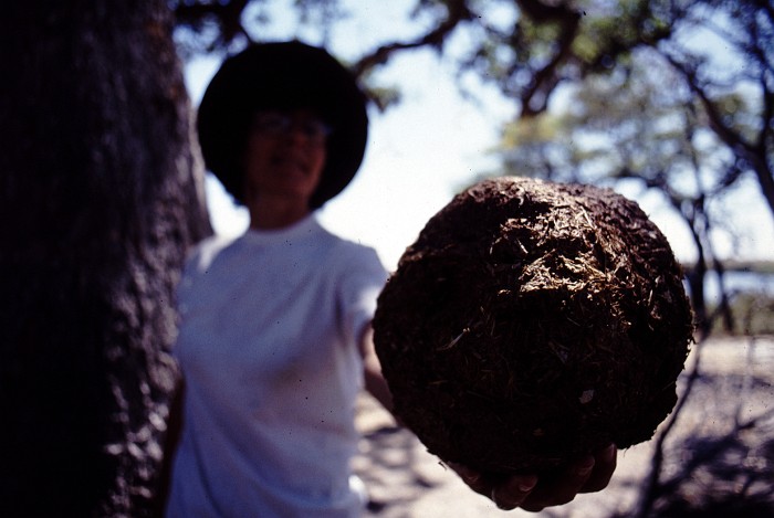
If you go closer to the water, you may see things
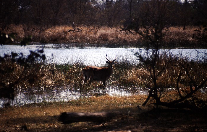
Moremi belongs to the premier wildlife observation parks in Africa. It has the kind of habitats that combine the vegetation of the East African Parks in Tanzania and Kenya with the desert plains of Namibia. Animal density is high. Tourism density is low and well controlled (meaning everything except the immediate environs of Maun is fairly pricey and up-market).

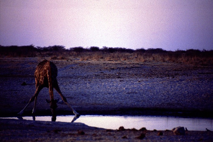
Chobe National Park
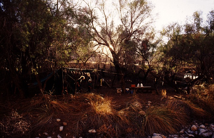
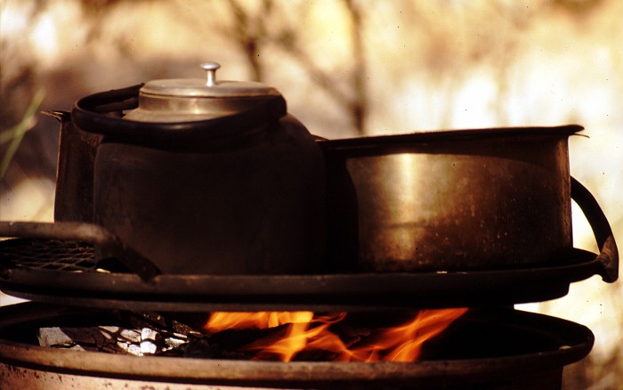
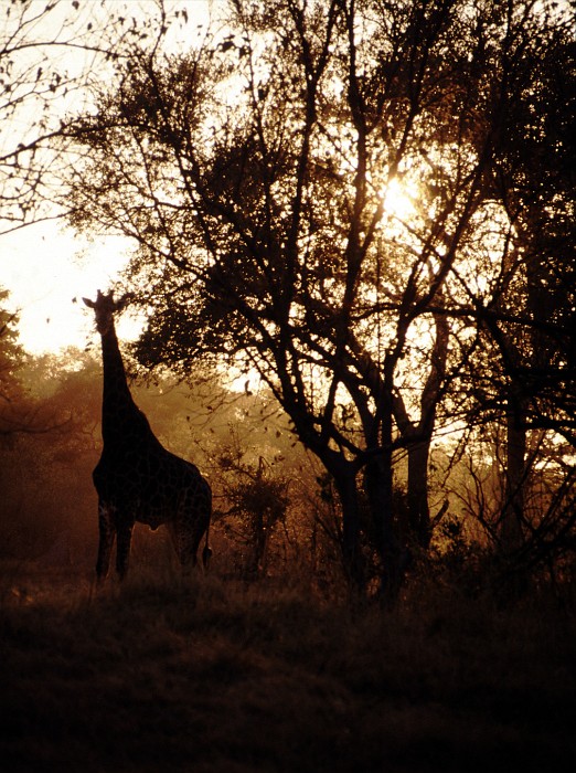
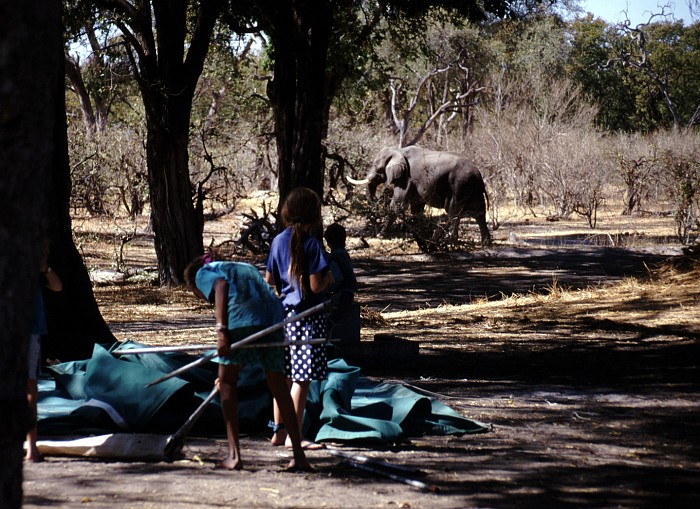
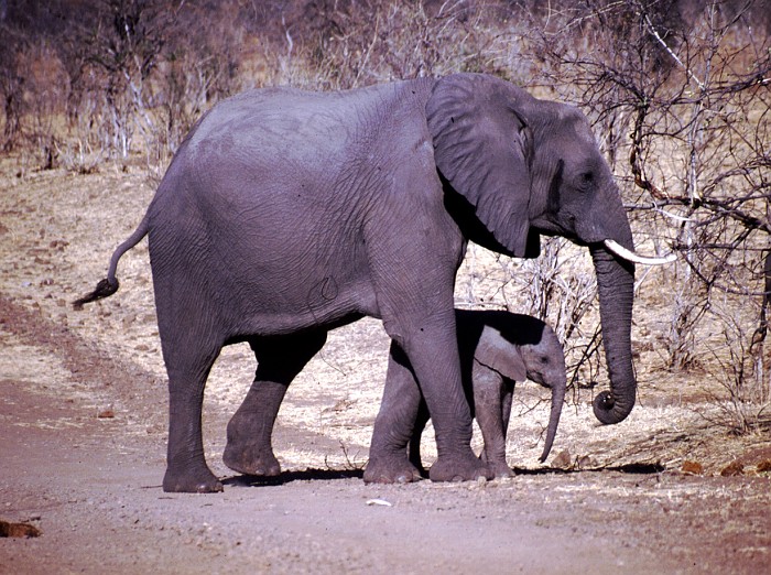
From Moremi, we cut through to Linyanti, a quiet corner of the Chobe National Park, with as many elephants as the Chobe Park is famous for. Traces of elephant abound around the camp. You don’t do much, except sitting in camp, relaxing, throwing bullshit, and waiting for the elephants to come and visit.
 !
!
and here they come:
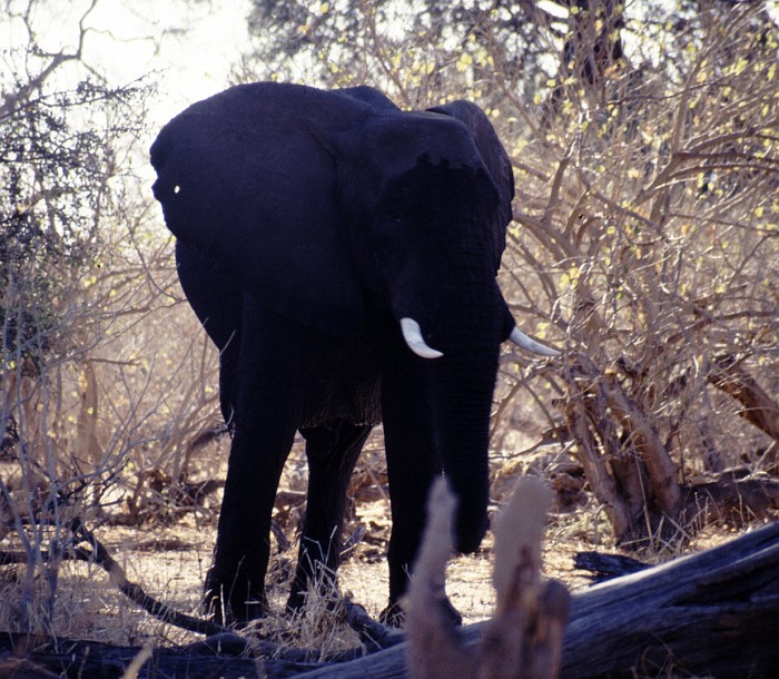
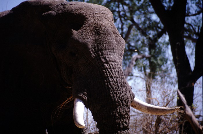
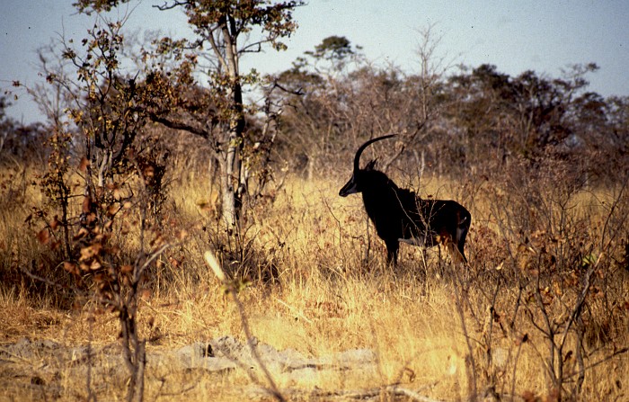
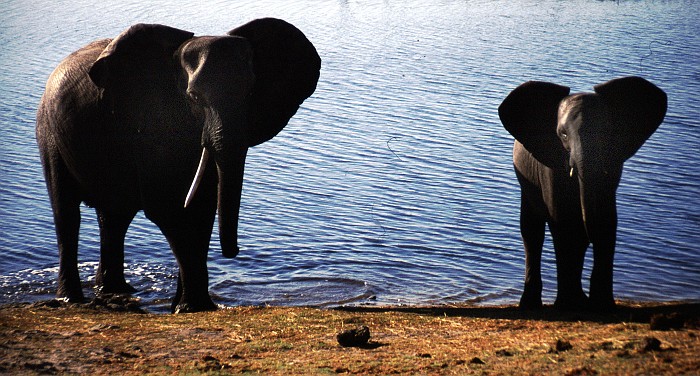
From Linyanti it is a relatively short drive to Chobe proper. Which again is different, but not because there are any fewer elephants. Here also a Sable Antelope, supposedly quite rare.
Zimbabwe
Having traveled more than 5,000 kilomters, we didn't have much more sense for the beauty of Zimbabe. Also, Hwange National Park was somewhat of a let-down, after the parks in Namibia and Botswana.
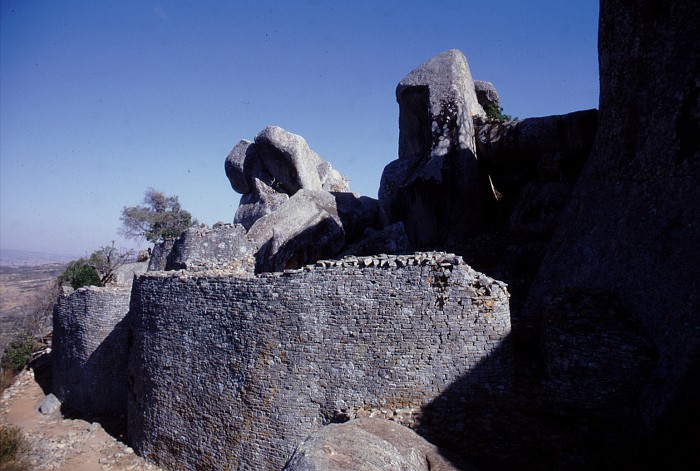
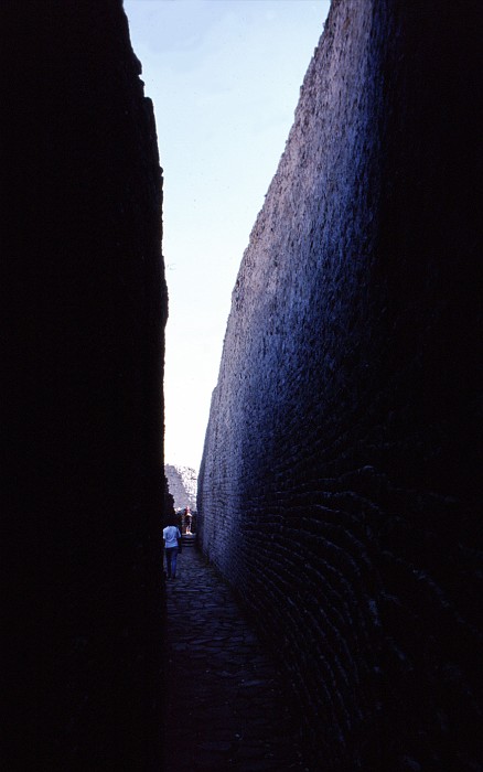
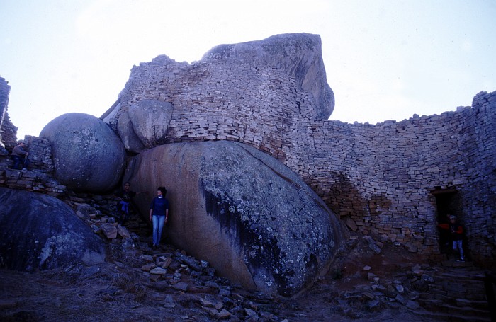
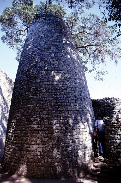
But then, Old Zimbabwe was well worth a stop.
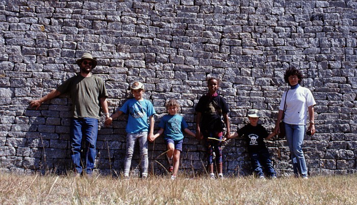
Because we lived in Malawi, we didn’t consider it part of the journey. Stories and pictures from Malawi can be found elsewhere on this website. There also is a companion page with mostly shots from our family taken during the trip, as mementos for family and friends.